What is recorded here
'St. Faned's Well', which is now almost filled in, consists of a stone-lined rectangular depression. It is situated in an area of fair pasture on a ledge of the S side overlooking the W end of Glencolumbkille valley. Described by Ó Muirgheasa in 1936 as 'There is a Tobar Fanaid in Killaned townland (Cill Fhanaid) in Glencolmcille, a stone's-throw from Cashel N. S. O'Donovan writes of it-" There was another chapel dedicated to St. Athnaid in the townland of Kilanaid but it is now level with the ground. A turns was performed there also. Does his name occur in the Calendar ? " It should be either Aedhnat, dau. of Raichen, 9th November, or Fiadhnat, 29th November and 4th January. St. Athnait's Cell and Roilig are near the well.' (Ó Muirgheasa 1936, 150). (Ó Muirgheasa No. 33)
The above description was derived from the 'Archaeological Survey of County Donegal. A description of the field antiquities of the County from the Mesolithic Period to the 17th century.' Compiled by: Brian Lacey with Eamon Cody, Claire Cotter, Judy Cuppage, Noel Dunne, Vincent Hurley, Celie O'Rahilly, Paul Walsh and Seán Ó Nualláin (Lifford: Donegal County Council, 1983). In certain instances the entries have been revised and updated.
Compiled by Caimin O'Brien
Date of upload/revision: 03 November 2011
Linked to St. Fanad (or Fanaid), an early Irish saint associated with Donegal, the well was traditionally visited for its healing properties, particularly for skin ailments and general well-being. The site reflects a broader Celtic Christian tradition of holy wells dedicated to local saints, often believed to be connected to spiritual or miraculous cures.
The monument record does not grant public access. Check the route and ask the landowner before entering private land.
- What survives
- Recorded monument
Places near here
 St. Faneds CellHermitage · 50 yd
 IndicatedHoly well · 119 yd
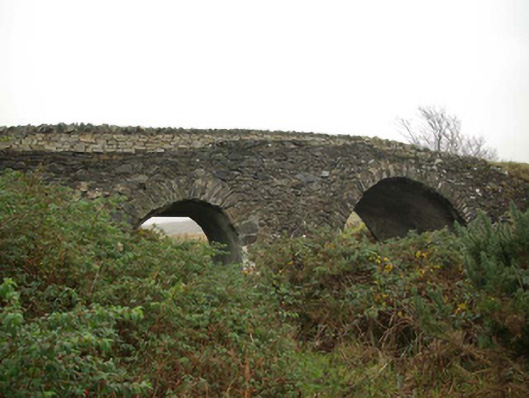 Droichead an tSráidbridge · 508 yd
 Glencolmcille Folk VillageMuseum · 512 yd
 Teach Pobail Naomh Columbachurch/chapel · 526 yd
 Trá an GhleannaBeach / strand · 544 yd
 An Trá Bheag (Trá Bheag an Ghleanna)Beach / strand · 794 yd
 Glencolmcille Old GraveyardGraveyard · 923 yd
 Rossan PointHeadland · 2.5 mi
 Silver Strand ViewpointViewpoint · 3.4 mi
 Slieve LeagueMountain / peak · 3.9 mi
 Slieve League SE TopMountain / peak · 4.3 mi
Other information
Photo: Credit not shown in the picture search · Rights wording not checked; contact us if this picture should be removed