What is recorded here
On a rise in undulating grassland, formerly part of Belview demesne. Shown on the 1838 edition of the OS 6-inch map an enclosed tree plantation. On the 1946 revision the interior is clear of trees. It is consists of a poorly preserved oval enclosure (57m E-W; 33m N-S) defined by a scarp (H 0.2m) and a shallow external fosse (Wth 1.5-2.3m; D 0.1-0.15m). Most likely a landscape feature.
Compiled by: Galway Archaeological Survey, UCG
Date of upload: 15 February 2019
The monument record does not grant public access. Check the route and ask the landowner before entering private land.
- What survives
- Recorded monument
Places near here
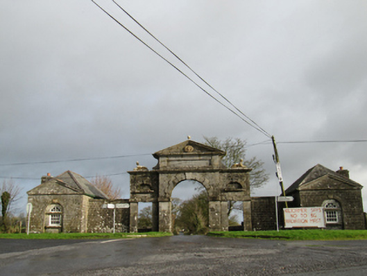 Belviewgates/railings/walls · 378 yd
 New GateRuins · 384 yd
 IndicatedFairy fort / earthen ringfort · 661 yd
 Enclosure in Ballydonagh (longford By.)Enclosure · 872 yd
 European YewEuropean Yew · 1.4 mi
 European BeechEuropean Beech · 1.6 mi
 Ballymore CastleCastle, tower house · 1.8 mi
 Oghil Castle (in ruins)Castle, tower house · 2.2 mi
 Redmond HillMountain / peak · 3.4 mi
 Urraghry HillMountain / peak · 5.4 mi
 The bloody HollowHeritage attraction · 5.4 mi
 Battle of AughrimMajor battlefield · 5.7 mi