What is recorded here
Indicated spans two kilometres across exposed karst in County Clare, linking Caherconnell and Eantybeg North through irregular boundaries that still shadow the scrub. Eleven cashels and ancient enclosures dot the line, suggesting people shaped this harsh ground long before modern farms arrived. The fields may preserve Bronze Age memory near Caherconnell or older megalithic practice near Eantybeg North, while reclaimed land has swallowed much of the surrounding pattern. What remains is a broken mosaic, visible only in patches, yet wide enough to have sustained an entire neighbourhood of lives now forgotten.
An extensive field system (c. 2km SW-NE; c. 500m NW-SE) stretching from Caherconnell at SW to Eantybeg North at NE and visible intermittently on Digital Globe (2011-2013) and on OSi Aerial Premium (2012-2018) in an area of exposed karst with patches of dense scrub cover. The fields are very irregular and are associated with 11 cashels including Caherconnell itself (CL009-030010-) and Caherlissaniska (CL009-045----) and a number of enclosures. Some parts of the field system may have prehistoric elements given the presence of a Bronze Age house (CL009-030018-) close to Caherconnell, a megalithic structure (CL009-045004-) in Eantybeg North and two unclassified cairns, one in Eantybeg North (CL009-147----) and one in Eantybeg South (CL009-170----). Many of the surrounding fields have been reclaimed.
Compiled by: Mary Tunney
Date of upload: 1 September 2021
The monument record does not grant public access. Check the route and ask the landowner before entering private land.
- What survives
- Recorded monument
Places near here
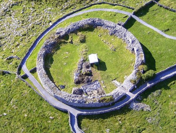 CaherlisnanroumFairy fort / stone ringfort · 240 yd
 CaherconnellHeritage attraction · 277 yd
 Fairy fort / stone ringfort in CaherconnellFairy fort / stone ringfort · 454 yd
 Caherconnell Stone FortRuins · 461 yd
 Poulnabrone - Burren GeositeVisitor information · 807 yd
 The Portal TombVisitor information · 953 yd
 Poulnabrone DolmenHeritage attraction · 1003 yd
 Cave of the Wild HorsesCave · 1048 yd
 Gleansleade Castle (in ruins)Castle, tower house · 1658 yd
 PoulnabroneMemorial · 1.3 mi
 Carran Church (in ruins)Church · 1.4 mi
 Site of Ballymurphy CastleCastle, tower house · 2.0 mi