What is recorded here
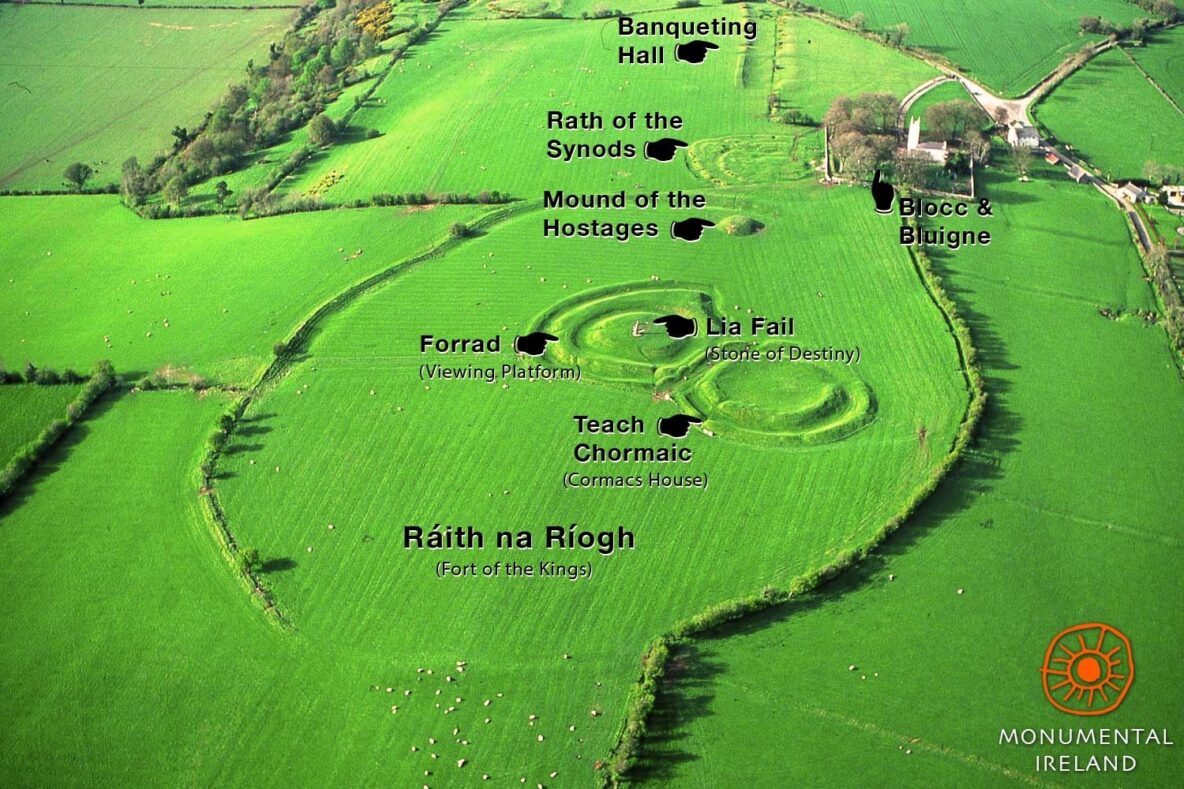
On a prominent gravel ridge, known locally as ‘Fahy's Hill’, in an area of flat pastureland. Regarded as a ringfort by Killanin and Duignan (1967, 69). Aerial imagery taken in 1970 (CUCAP BDN 37) shows that a large quarry was being developed immediately to its E. Consequently in 1971 a rescue excavation was undertaken by E. Rynne (pers. comm.) who described it as a large earthwork (max. diam. c. 68m) comprising a flat-topped mound (diam. c. 28m) encircled by a fosse and external bank. There was a gap (Wth 6m) at SE. Within the interior was a semicircular enclosure (diam. c. 5.5m) defined by a bank with an external shallow fosse. A number of seemingly haphazardly placed pits and/or post holes occurred in this area. Also found in this vicinity were two concentrations of cremated bones and one shallow cremation-burial. Rynne (ibid.) concluded that the exposed position and the complete lack of any trace of a hearth, together with the widespread scatter of small fragments of cremated bones, suggested that the site was not used for habitation but was more likely used for ritual purposes; it may have been an assembly place or an inauguration mound. No visible surface trace survives. A ring-barrow (GA114-088----) lay c. 30m to the NE.
Compiled by: Galway Archaeological Survey, UCG
Date of upload: 12 August 2019
The monument record does not grant public access. Check the route and ask the landowner before entering private land.
- What survives
- Recorded monument
Places near here
 Enclosure in Grannagh (loughrea By.)Enclosure · 414 yd
 bridgebridge · 621 yd
 Enclosure in Bullaunagh (kiltartan By.)Enclosure · 762 yd
 Saint Teresa's Catholic Churchmausoleum · 1136 yd
 Castle (in ruins)Castle, Anglo-Norman masonry castle · 1609 yd
 Rahaly Castle (in ruins)Castle, tower house · 1.3 mi
 European ashEuropean ash · 3.4 mi
 HawthornHawthorn · 3.4 mi
 KnockapollboyMountain / peak · 4.2 mi
 Drumharsna CastleHeritage attraction · 4.6 mi
 Scalpeen RockNamed rock · 4.7 mi
 KnocknarebanaMountain / peak · 5.9 mi
Other information
Photo: Credit not shown in the picture search · Rights wording not checked; contact us if this picture should be removed