What is recorded here
Situated on NW facing slope of heather covered mountain. In area of cut-away bog are the remains of a three hut sites (DG096-035001/002-) found in close proximity to each other. A roughly oval-shaped hut site (int. dims. 3.42m x 2.03m) defined by a a single line of orthostats (H 0.46m; T 0.33m) protruding above the heather covered ground with no clear entrance gap visible. Two hut sites (DG096-035001/002-) are located 18m and 30m to the S.
Compiled by: Caimin O'Brien
Date of upload/revision: : 19 July 2010
The monument record does not grant public access. Check the route and ask the landowner before entering private land.
- What survives
- Recorded monument
Places near here
 Cruachlann Stone EnclosureEnclosure · 388 yd
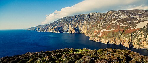 Slieve LeagueViewpoint · 819 yd
 Carrigan Head Signal TowerRuins · 830 yd
 Comhartha Túr an Ceann an Charraigínwatch tower, signal tower · 831 yd
 An Seanbhaile Coastal Promontory FortPromontory fort, coastal · 1058 yd
 International Appalachian Trail Ulster-IrelandWalking route · 1.2 mi
 Cliffs at TeelinPublicly named cliff or headland · 1.7 mi
 Slieve League SE TopMountain / peak · 1.8 mi
 Dundawoona Point / Pointe an DúinHeadland · 2.1 mi
 TraloarBeach / strand · 3.6 mi
 CroaghmuckrosMountain / peak · 3.7 mi
 TrabaneBeach / strand · 3.9 mi