What is recorded here
Located about 250m S of KE087-009---- is a slightly elevated triangular platform that measures 18.5m x 13m in overall dimensions. Towards its N end are the sod-covered foundations of two huts. Extending from their S limits are two earth and stone banks, the longer one measuring 10.3m. The hut at W is subrectangular in plan, measuring 5m internally. Its drystone foundations are flanked by an inner row of basal uprights at E. Its wall is .45m high and 1.2m thick. Immediately NE are the foundations of a circular drystone hut, revetted by a number of uprights along its inner wall-face. D: 2.2m.
Close to the modern field boundary which runs nearby the complex at E is an opening to a well-built, drystone Man-made underground passage. Access to the passage is gained by removing a roof lintel. The passage measures 1.95m long N-S, .6m wide and .9m high and narrows toward its rounded end-walls. An earth-cut creepway opens off its SE corner and gives access to an E-W passage, the uppermost stone courses of which are slightly corbelled. It measures .7m wide, .9m high and 1.8m long. Roof collapse prevents further access.
The above description is derived from A. O'Sullivan and J. Sheehan (compilers), 'The Iveragh peninsula: an archaeological survey of South Kerry'. Cork University Press (1996), no. 1199. In certain instances the entries have been revised and updated in the light of recent research.
Date of upload: 31 July 2013
The monument record does not grant public access. Check the route and ask the landowner before entering private land.
- What survives
- Recorded monument
Places near here
 Telegraph Field Valentia IslandMemorial · 267 yd
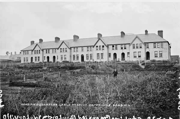 Anglo American Cable House, Telegraph FieldMonument · 335 yd
 Cromwell's FortRuins · 587 yd
 PlatformPlatform, peatland · 602 yd
 Old Watch TowerRuins · 640 yd
 Horse IslandIslet · 1617 yd
 Skellig Experience CentreMuseum · 1.1 mi
 Long IslandIslet · 1.2 mi
 Bray HeadMountain / peak · 1.3 mi
 Culloo RockViewpoint · 1.3 mi
 Fogher CliffCliff · 2.5 mi
 Tobairin Holy WellSpring · 2.6 mi
Other information
Photo: Credit not shown in the picture search · Rights wording not checked; contact us if this picture should be removed