What is recorded here
Bolart Corn mill still stands beside Cloghatanny river, but the rectangular hut nearby has surrendered to grass and memory. Its stone footings mark a narrow chamber perhaps built to store grain, shelter workers or hide tools from rain. The river has washed away the roof, the doors and most of the reason it existed. What remains is a shallow box drawn in earth, waiting for someone to imagine the hands that carried its stones.
Rectangular shaped stone hut situated on the W bank of Cloghtanny river about 100m north of Bolart Corn mill. Only the grass covered wall footings survive of a small rectangular building orientated (int. dims. 12.4m E-W; 4.4m N-S; wall T 1.5m approx.). Possibly associated with the nearby 19th-century corn mill.
The above description is derived from the published 'Archaeological Inventory of County Offaly' (Dublin: Stationery Office, 1997). In certain instances the entries have been revised and updated in the light of recent research.
Date of upload: 23 May 2011
The monument record does not grant public access. Check the route and ask the landowner before entering private land.
- What survives
- Recorded monument
Places near here
 Field system in Greenville OR GarryduffField system · 331 yd
 IndicatedFairy fort / ringfort · 985 yd
 Roughan HillMountain / peak · 1141 yd
 ToberaskeenSpring · 1342 yd
 Church (in Ruins), Grave YardChurch · 1566 yd
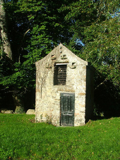 Ashmount Housedovecote/pigeon house/aviary · 1710 yd
 Gorteen CastleCastle, unclassified · 1.3 mi
 Inchaloon IslandIslet · 1.5 mi
 Chapel HillForest · 2.5 mi
 Clara Bog BoardwalkWalking route · 2.6 mi
 Kilcoursey Castle (in Ruins)Bawn · 2.9 mi
 Moate HillMountain / peak · 3.5 mi
Other information
Photo: Credit not shown in the picture search · Rights wording not checked; contact us if this picture should be removed