
What is recorded here
House was a prehistoric circular dwelling at the foot of a ridge in County Limerick, Ireland, with a stone-lined well and burnt hearths. James Eogan and Sinclair Turrell excavated it in 1999 after road works exposed the site. The penannular ditch marked the base of a wall, while post-holes and a central hearth suggested a lived-in interior. The well contained animal bone and charcoal, hinting at daily use and perhaps ritual. Though no longer visible on the surface, the shape of the place remains in the depth of its making.
At the foot of a ridge, in wet pasture, 120m S of a townland boundary with Attyflin. Another prehistoric excavation (LI021-166----) lies 200m to S. Not depicted on OS historic mapping. Monument identified in 1999 as a possible prehistoric settlement during monitoring of topsoil-stripping on the N20/N21 Adare to Annacotty Road Improvement Scheme. It was excavated (Licence No. 99E0341) by James Eogan and Sinclair Turrell and was described as a penannular ditch, post-holes, several burnt areas and a linear ditch filled with a very dark soil that contained a considerable amount of burnt stone and charcoal (Eogan and Turrell 2000, 1; Eogan and Turrell 2000, 160). Most of the features were very shallow, except a large pit (3.35m x 3.5m) to E of the penannular ditch, which proved to be a stone-lined well.
The pennanular ditch (Wth 0.5-0.9m) probably represents a slot trench of a circular structure (approx. diam. 10m), having an entrance to the S (ibid). A possible ring of posts around the outside of the ditch may have provided wall supports and an inner ring of posts probably supported the roof. A central hearth along with a number of stake-holes suggests other internal features (ibid). A series of post-holes to N of the well and some hearths may date earlier than the pennanular structure, which is probably contemporary with the well and the majority of the hearths and pits. Another set of hearths and pits, together with a linear ditch, seem to represent later features (ibid).
The well shaft (D 0.6m) was excavated (D 2.4m) and was lined with large, undressed stones set in clay (ibid). Some flat stones were placed around the mouth of the well to provide access. There was a considerable amount of burnt stone in the fill and in the clay lining of the well. Some animal bone and wood were found in the lower fill of this feature. It is anticipated that wood, bone and charcoal samples will provide enough material for radiocarbon dates. Monument not visible on Digital Globe orthophotos taken 2011-13 or on Google Earth orthoimages taken 28/06/2018.
See attached Google Earth orthoimage.
Compiled by: Alison McQueen and Vera Rahilly
Date of upload: 6 August 2020
The monument record does not grant public access. Check the route and ask the landowner before entering private land.
- What survives
- Recorded monument
Places near here
 Killasragh Infants' Burial GroundArchaeological place · 347 yd
 Settlement desertedSettlement deserted, medieval · 411 yd
 Attyflin Housecountry house · 785 yd
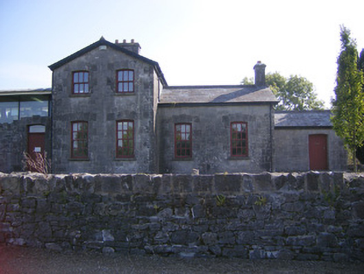 Patrickswell Railway Stationrailway station, signal box · 1280 yd
 Ballinveala Castle (in ruins)Castle, tower house · 1.5 mi
 Fanningstown Castle (in ruins)Castle, tower house · 2.3 mi
 Villiers WellSpring · 3.6 mi
 Biodiversity in the Maigue CatchmentVisitor information · 4.0 mi
 Dysert AenghusaHeritage attraction · 4.1 mi
 European ashEuropean ash · 4.6 mi
 Monasteranenagh AbbeyHeritage attraction · 4.9 mi
 St James's WellSpring · 5.0 mi
Other information
Photo: Credit not shown in the picture search · Rights wording not checked; contact us if this picture should be removed