What is recorded here
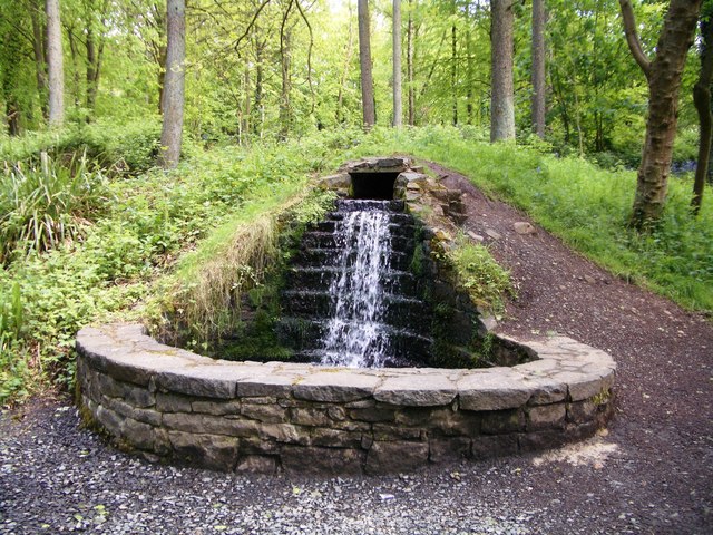
Mullinsallagh holds a holy well whose age and exact purpose remain uncertain. The official record points to a marked archaeological site in County Antrim, but it offers no date, owner, event or visible structure. The uncertainty does not weaken the place; it removes the false claim of a complete answer. A well may have served neighbourhood prayer, seasonal ritual or ordinary drinking before memory faded. People may have visited it during feast days, illness or birth, then stopped coming when the road changed or the field was taken. What is known is that the site still exists and is recognised as a holy well. The missing details are not a failure of imagination, but a boundary of evidence.
The official Northern Ireland record identifies this as HOLY WELL. Recorded period: UNCERTAIN. The official map point was placed at the centre of the recorded archaeological site from the source map reference.
Linked to Saint Fillan, the well is traditionally associated with cures for skin ailments and was once visited by pilgrims who collected water for healing rituals. The site reflects a broader Celtic Christian tradition of holy wells as places of spiritual and physical healing.
The monument record does not grant public access. Check the route and ask the landowner before entering private land.
- What survives
- Recorded monument
Places near here
 Portglenone ForestForest · 198 yd
 Masonic HallHall · 983 yd
 Top WoodWood · 1046 yd
 First Presbyterian ChurchChurch · 1258 yd
 ENCLOSURE (unlocated) in AughnahoyENCLOSURE (unlocated) · 1264 yd
 CASTLE (site of): PORTGLENONE CASTLE in GarvaghyCASTLE (site of): PORTGLENONE CASTLE · 1307 yd
 ENCLOSURE in GarvaghyENCLOSURE · 1513 yd
 FORD across R. BANN & SITE OF BATTLE, 1689 (see also ANT 031:052 for opposite side of the river) in GlenoneFORD across R. BANN & SITE OF BATTLE, 1689 (see also ANT 031:052 for opposite side of the river) · 1.1 mi
 TullyMountain / peak · 1.6 mi
 Scroggy Mass RockNamed rock · 2.9 mi
 Seamus HeaneyMemorial · 3.8 mi
 PLANTATION CASTLE & BAWN on site of RATH: BELLAGHY BAWN in Old Town Deer ParkPLANTATION CASTLE & BAWN on site of RATH: BELLAGHY BAWN · 4.4 mi