What is recorded here
Newry has accumulated human life since medieval times, with distinct settlement layers continuing through the eighteenth, nineteenth and twentieth centuries. The town is not a sudden invention but a repeated choice, where people returned to the same ground, rebuilt after loss, and expanded the old footprint. Each era added rooms, roads and memories, making the settlement a living record of continuity rather than a single dated event.
The official Northern Ireland record identifies this as HISTORIC SETTLEMENT: NEWRY. Recorded period: C18TH; MEDIEVAL; C19TH; POST-MED; LATE-MED; C20TH. The official map point was placed at the centre of the recorded archaeological site from the source map reference.
The monument record does not grant public access. Check the route and ask the landowner before entering private land.
- What survives
- Recorded monument
Places near here
_along_John_Mitchell_Place_-_geograph.org.uk_-_3967822.jpg?width=1280) First Non- Subscribing Presbyterian ChurchChurch · 79 yd
First Non- Subscribing Presbyterian ChurchChurch · 79 yd Newry CanalVisitor information · 122 yd
 John Mitchel StatueMonument · 136 yd
 Bagenal's CastleCastle · 223 yd
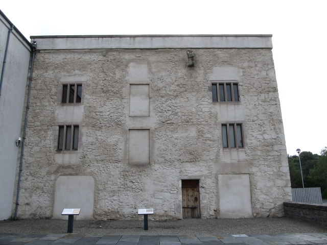 TOWER-HOUSE: BAGENAL'S CASTLE in NewryTOWER-HOUSE: BAGENAL'S CASTLE · 224 yd
 Newry and Mourne MuseumMuseum · 232 yd
 Ballybot BridgeBridge · 313 yd
 Canal Bank 1 Car ParkVisitor information · 323 yd
 CROSS SLAB in BallynacraigCROSS SLAB · 555 yd
 1971 Newry killingsmassacre · 590 yd
 Newry CenotaphMemorial · 759 yd
 POST-MEDIEVAL CHURCH & GRAVEYARD: ST. PATRICK'S in NewryPOST-MEDIEVAL CHURCH & GRAVEYARD: ST. PATRICK'S · 834 yd