What is recorded here
Located on a slight rise in the flood plain of the NW-SE River Blackwater, with the stream c. 150m to the SW. The site of the early church founded by St. Patrick and of the medieval parish church of Donaghpatrick (ME017-034006-) is in the the subrectangular graveyard (dims c. 90m NW-SE; c. 60m NE-SW) defined by masonry walls, with iron railings on the roadside at NE where the Church of Ireland Church of St. Patrick is now situated. The standing stone (ME017-034002-) and font (ME017-034003-) are in the graveyard, and the sundial (ME017-034004-) is incorporated in the outer face of the graveyard wall at SE.
Compiled by: Michael Moore
Date of upload: 5 June, 2014
Early Christian cemetery, likely 5th–9th century AD, associated with the foundation of the early church by St. Patrick and the later medieval parish church of Donaghpatrick. The site represents an important ecclesiastical and burial complex in the early Irish Christian tradition.
The monument record does not grant public access. Check the route and ask the landowner before entering private land.
- What survives
- Recorded monument
Places near here
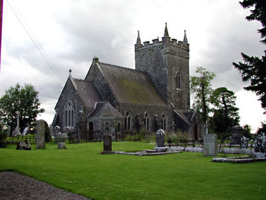 Saint Patrick's Church (Donaghpatrick)church/chapel · 17 yd
 Font in Diméin Bhaile GhibFont · 18 yd
 sexton's housesexton's house · 61 yd
 Rath AirthirCeremonial enclosure · 164 yd
 Gibbstown House EntranceWood · 1756 yd
 Randalstown HseCastle, unclassified · 1.7 mi
 TuliptreeTuliptree · 2.2 mi
 Liscartan CastleCastle, tower house · 2.3 mi
 Faughan HillMountain / peak · 2.5 mi
 BallybegMountain / peak · 2.8 mi
 The New Line RoadMemorial · 3.2 mi
 Donaghmore Round TowerHeritage attraction · 4.4 mi