Why this matters
A local ancient tomb; wider significance not recorded.
Overview
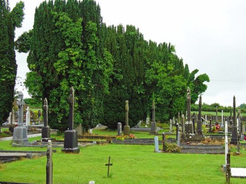
Grave Yard — Clashmore is recorded as Graveyard in Waterford. Located towards the bottom of a S-facing slope on the N bank of the Greagagh River at a point where it changes from a NE-SW direction and turns W to join the N-S River Blackwater c. 2.3km to the W. The site of an early church (WA037-008001-) and the site of the parish church of Clashmore (WA037-008002-) are within a rectangular graveyard (dims.
Who made it and when
The saved account records: c. 125m E-W) W of the graveyard produced only post-medieval features (Lynch 2009).
How it was made and used
The saved account records: Located towards the bottom of a S-facing slope on the N bank of the Greagagh River at a point where it changes from a NE-SW direction and turns W to join the N-S River Blackwater c. 2.3km to the W.
What was found
The saved account records: Archaeological excavation (07E0051) on a small site c. 40m N of the graveyard produced no related material (Lynch 2010b), and testing (06E1088) on a large area (dims.
What remains
The saved account records: (1896b) The ancient ruined churches of Waterford.
Why it mattered
Grave Yard — Clashmore matters because material evidence was found or examined here, allowing the place to answer questions that its name alone cannot. The source records: Archaeological excavation (07E0051) on a small site c. 40m N of the graveyard produced no related material (Lynch 2010b), and testing (06E1088) on a large area (dims. The examination or finds give physical evidence for date, use or human activity rather than leaving the account as guesswork.
History checked 15 August 2026 against the named sources below.
Add the human story, a picture, a first-hand message or a missing place.
Earn 5 points after the picture is checked and accepted.
Add a pictureAdd its storyTalk or ask a questionAdd a new placeThe monument record does not grant public access. Check the route and ask the landowner before entering private land.
Conversation about this place
Questions and messages sit beneath the source record. They are checked before appearing.
No questions or messages yet.
Ask a question or join the conversation