What is recorded here
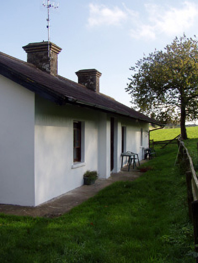
At end of lane to N of road. Indicated on 1842 OS 6-inch map as part of settlement of 'Garrynagoul'. Long front (S) elevation of 6 bays, off-centre door to left. Roof hipped to W, gabled to E with modern additions; thatched with off-centre chimney to left.
The above description is derived from the published 'Archaeological Inventory of County Cork. Volume 4: North Cork' (Dublin: Stationery Office, 2000). In certain instances the entries have been revised and updated in the light of recent research.
Date of upload/revision: 14 January 2009
The monument record does not grant public access. Check the route and ask the landowner before entering private land.
- What survives
- Recorded monument
Places near here
 IndicatedKiln, lime · 652 yd
 Marstongate lodge · 1401 yd
 Ecclesiastical enclosure in Kilcoran SouthEcclesiastical enclosure · 1657 yd
 Mocollop Castle (in ruins)Castle, Anglo-Norman masonry castle · 1729 yd
 Sheanmore Castle (in ruins)Castle, tower house · 1.2 mi
 Mocollop Picnic SitePicnic place · 1.3 mi
 Tobar MocudaHoly well · 1.4 mi
 Graveyard in Curraheen (kinnatalloon By.)Graveyard · 2.9 mi
 Saint Micheal's Holy WellSpring · 3.1 mi
 Castlebrook forestWood · 3.1 mi
 KnocknaloughMountain / peak · 3.6 mi
 Natural heritage of CoolagowanVisitor information · 4.1 mi