What is recorded here
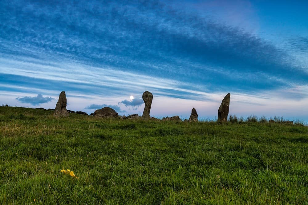
Five stones still stand on a south-facing slope above the Glashagloragh river, though the northern entrance has fallen and field stones have crowded the middle. The circle measures 2.7m along its NE-SW axis, small enough for a handful of people to gather inside. It is the kind of place where someone once arranged rock with purpose, then left it to weather, grass and forgetting.
On shoulder of S-facing hill slope, N of Glashagloragh river. Circle complete; N entrance stone has fallen; interior filled with field stones. Orthostats are 0.7m to 1.7m L, 0.15m to 0.6m T and 1m to 1.4m H. Internal measurement along main axis, aligned NE-SW, is 2.7m. (O Nualláin 1984, 44, no. 89; Roberts 1988, no. 9)
The above description is derived from the published 'Archaeological Inventory of County Cork. Volume 1: West Cork' (Dublin: Stationery Office, 1992). In certain instances the entries have been revised and updated in the light of recent research.
Date of upload/revision: 14 January 2009
The monument record does not grant public access. Check the route and ask the landowner before entering private land.
- What survives
- Recorded monument
Places near here
 Enclosure in Knockawaddra (carbery East (w.d) By.)Enclosure · 711 yd
 Stone Circle ( Maulathanavalla )Archaeological place · 1490 yd
 Flour MillMill, corn · 1.3 mi
 Flax MillMill, flax · 1.5 mi
 Cross commemorating Holy Day.Memorial · 1.9 mi
 CarrigfaddaMountain / peak · 2.0 mi
 Jeremiah O'Donovan RossaMemorial · 2.3 mi
 Ballinvard CastleCastle · 3.2 mi
 Mohona WoodWood · 3.5 mi
 Ballynacarriga CastleCastle, tower house · 3.6 mi
 Michael Collins BirthplaceHistoric birthplace · 4.7 mi
 Dunmanway Heritage CentreVisitor information · 4.8 mi