What is recorded here
In marshy ground. Heavily overgrown horseshoe-shaped mound of burnt material (diam. 20m; H 1.6m); opening faces SE. Mound enclosed by low bank (int. H 0.3m; ext. H 0.9m) and external waterlogged fosse (D 0.3m). Shown on 1842 OS 6-inch map as circular enclosure, planted with trees, on demesne of Dromore House. Unusual bank and fosse may result from this planting. Second fulacht fiadh (10761) c. 80m to W and third (10760) c. 110m to W. Possibly the fulacht fiadh on J. Long's land described as '20 yds in diam.' by Bowman (1934, 599).
The above description is derived from the published 'Archaeological Inventory of County Cork. Volume 4: North Cork' (Dublin: Stationery Office, 2000). In certain instances the entries have been revised and updated in the light of recent research.
Date of upload/revision: 14 January 2009
The monument record does not grant public access. Check the route and ask the landowner before entering private land.
- What survives
- Recorded monument
Places near here
 Fulacht fia in Dromore (duhallow By.)Fulacht fia · 105 yd
 Man-made underground passage in DrommahaneMan-made underground passage · 351 yd
 Quarry in Dromore (duhallow By.)Quarry · 696 yd
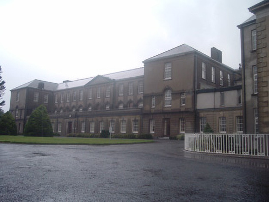 Nazareth Housecountry house · 1282 yd
 Blackwater WayWalking route · 2.0 mi
 Castle Barrett (in Ruins)Castle, Anglo-Norman masonry castle · 2.1 mi
 Castle BarrettCastle · 2.1 mi
 In loving memory of Elvis O'DonoghueMemorial · 2.6 mi
 Dromaneen CastleHeritage attraction · 2.8 mi
 Bweeng LittleMountain / peak · 4.6 mi
 Lyradane MountainMountain / peak · 5.1 mi
 Knockduff Wind FarmVisitor information · 6.8 mi