What is recorded here
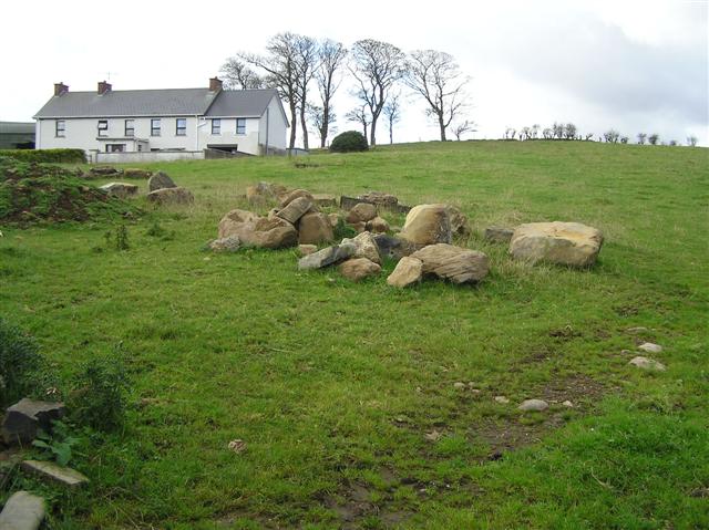
On a narrow terrace (Wth 10m) towards the base of the S-facing slope of Turlough Hill. The terrace is backed at N by a low rock face and a spring issues from its base. A substantial, compact horseshoe-shaped mound (c. 14m N−S; 12m E−W) of burnt stones, enclosing a central depression which opens to the spring at E. The mound is composed of a dense concentration of small limestone fragments in black, charcoal-rich soil, which is exposed in parts where the thin sod covered is eroded. The U-shaped central depression (6m E−W; 3m N−S at E end; D below N arm 1.18m; below S arm 0.6m) is narrow at W and splays open at E where it faces the spring. A kerb of low, close-set or contiguous upright stones, protruding 0.25-0.3m above the sod, defines the curving narrow W end of the depression. The spring is currently used as a source of water; a number of large boulders have been piled around it. Another fulacht fia (CL006-021----) lies c. 700m to S and is visible from this site.
The following images have been uploaded:
CL007-076----_01.jpg View from SE
CL007-076----_02.jpg View from S
CL007-076----_03.jpg View from NW
CL007-076----_04.jpg Kerb at W end of trough
CL007-076----_05.jpg Burnt stone and charcoal-rich soil exposed on E side of mound
Revised by: Mary Tunney and Jane O'Shaughnessy
Date of revision: 9 November 2021
The monument record does not grant public access. Check the route and ask the landowner before entering private land.
- What survives
- Recorded monument
Places near here
 Enclosure in KnockycallananEnclosure · 746 yd
 Turlough HillMountain / peak · 949 yd
 Hillfort in OughtmamaHillfort · 1002 yd
 Oughtmama Church (in ruins)Church · 1660 yd
 Church (in ruins)Church · 1664 yd
 Corcomroe AbbeyVisitor information · 1.8 mi
 Corcomroe Abbey Geopark SiteVisitor information · 1.8 mi
 Turlough CastleArchaeological place · 1.9 mi
 Grave of Saint Mac Duagh's ServantArchaeological place · 2.0 mi
 Battle of Lough Raskabattle · 2.2 mi
 Castle Mael (in ruins)Castle, unclassified · 2.4 mi
 Abbey HillMountain / peak · 2.5 mi