What is recorded here
Knockash holds a faded stone ring where a television mast now pierces the sky, proving that human ambition still claims even forgotten ground. The low bank survives best at the east, marking a small domestic world reduced to grass and memory. A square annex clings to the south, suggesting people lived there before the airwaves arrived. The site resists easy judgment because modern utility has entered an ancient chamber, forcing both to share the same restricted space.
Some 100m to the E of a hillfort (GA115-042----). Aerial reconnaissance in June 1986 (ASGAP 267:6) revealed this poorly preserved subcircular cashel (25.5m N-S; 21.6m E-W). It is defined by a low grassed-over stony bank that is visible all round but is best preserved at E (Wth 3m; int. H 0.3m; ext. H 0.65m). A TV/communications mast and a concrete shed have been constructed in the interior. Abutting the monument at S is a very poorly preserved, almost square, annexe or house site (N-S 6m; E-W 5m). It is composed of natural clints from the surrounding outcropping rock and small stones.
Compiled by: Galway Archaeological Survey, UCG
Date of upload: 10 January 2018
The monument record does not grant public access. Check the route and ask the landowner before entering private land.
- What survives
- Recorded monument
Places near here
 TobermacduaghHoly well · 458 yd
 Lisheenaclara Bridgebridge · 1073 yd
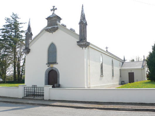 Saint Mary's Catholic Churchchurch/chapel · 1414 yd
 CaveMan-made underground passage · 1.0 mi
 Stone Islands SouthIslet · 2.2 mi
 Ballynamantragh CastleCastle, unclassified · 2.3 mi
 Island McCooIslet · 2.4 mi
 Long PointHeadland · 2.5 mi
 Castle (in ruins)Castle, tower house · 2.7 mi
 Scalpeen RockNamed rock · 4.1 mi
 Derrybrien Bog SlideHeritage attraction · 5.3 mi
 Dartfield Horse MuseumHeritage attraction · 5.4 mi