What is recorded here
The road cuts the oval cashel at both ends, but the southern wall still stands tall in the level grassland. Inside that protected sector, a rectangular house and a smaller D-shaped hut remain visible among the stones. People may have built the larger space for living and the smaller one for storage or worship, yet the road now divides what the stones once kept whole.
In level grassland. Oval cashel (E-W 44.2m, N-S 38.6m), in fair condition, defined by a drystone wall. The td. boundary cuts the monument at E and W, and the enclosing element is best preserved to S of it. Within S sector of the interior are two structures: (a GA057-025001-) to W is a rectangular house (E-W; L 10.4m, Wth 6.4m), with an internal division, defined by a line of boulders and small stones; (b GA057-025002-) to E is a D-shaped structure (E-W; L 1.94m, Wth 1.05m) of similar construction, possibly a hut.
The above description is derived from the published 'Archaeological Inventory of County Galway Vol. II - North Galway'. Compiled by Olive Alcock, Kathy de hÓra and Paul Gosling (Dublin: Stationery Office, 1999).
Date of upload: 05 August 2010
The monument record does not grant public access. Check the route and ask the landowner before entering private land.
- What survives
- Recorded monument
Places near here
 IndicatedEnclosure · 432 yd
 Church in AucloggeenChurch · 949 yd
 Enclosure in TurloughgarveEnclosure · 1.0 mi
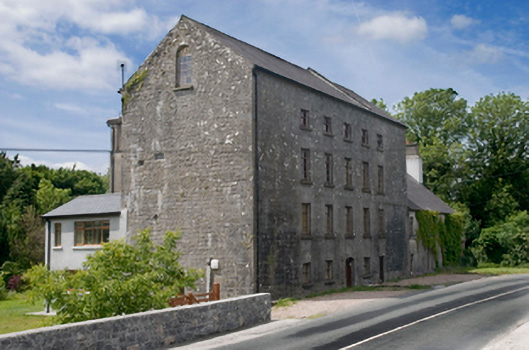 Cregg Millsmill (water) · 1.2 mi
 Cregg Castle DemesneForest · 1.3 mi
 Drumgriffin Castle (in ruins)Castle, unclassified · 1.7 mi
 Cregboyne FortBawn · 2.0 mi
 European BeechEuropean Beech · 3.2 mi
 Kilcoona Round TowerHeritage attraction · 4.3 mi
 Ballinduff BayBay · 4.4 mi
 Oileán an AoilIsland · 5.9 mi
 Oileán an BhreathnaighIslet · 5.9 mi