What is recorded here
Knockanure Church stands beside a two-thirty metre earthen ring where human hands shaped the land before religious stone arrived. The fairies may have borrowed the fort after people left it, but the measurements belong to humans: a five metre bank, a raised interior, and a complete circular boundary. That is a house, a defensible home, or a boundary marker made by living people. The fairy name is a later story told beside the shape, not a reason to stop taking the shape seriously.
Internal diameter 22m N-S, 23m E-W
Lissanfarran/Lios an Fhearainn (ringfort of the land) is situated immediately N of the ruined Knockanure Church (941). This univallate rath consists of a circular area enclosed by a well-defined earthen bank. The enclosing bank is on average 5m in width; it rises to 1.3m above the surrounding land and .6m-1.1m above the interior. The interior is at a slightly higher level than the surrounding land.
The above description is derived from C. Toal, ‘North Kerry Archaeological Survey’. Dingle. Brandon in association with FAS Training and Employment Authority (1995), no. 434. In certain instances the entries have been revised and updated in the light of recent research.
Date of upload: 2 August 2013
The monument record does not grant public access. Check the route and ask the landowner before entering private land.
- What survives
- Recorded monument
Places near here
 LissanfarranArchaeological place · 9 yd
 LisnabroArchaeological place · 885 yd
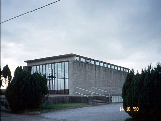 Corpus Christi Catholic Churchchurch/chapel · 1117 yd
 Duagh Church (in ruins)Church · 2.4 mi
 CastleCastle, tower house · 2.8 mi
 John B. KeaneMemorial · 4.0 mi
 Statue of SchillerMemorial · 4.0 mi
 Kerry Writers' MuseumMuseum · 4.5 mi
 Listowel Castle (in ruins)Castle, tower house · 4.5 mi
 Lartigue MonorailMuseum · 4.6 mi
 Lawson's CypressLawson's Cypress · 4.7 mi
 Siege of Carrigafoyle Castlesiege · 9.3 mi