What is recorded here
Kilclaremore holds a genuine earthen ringfort on a drumlin, not a fake fairy circle. Its steep bank, narrow entrance and surrounding ditch still mark the shape of a lived place, even though trees and field banks have cut across it. People may have farmed, hidden or worshipped there before the land was forgotten. The fort does not need fairy tales to be strange because it is still standing while most human traces have vanished.
Located on top of a drumlin. This is a subcircular or oval area (int. dims 42m E-W; 35m N-S) defined by a steep-sided earthen bank (Wth 4.2m; int. H 0.55m; ext. H 1.35m) and external flat-bottomed fosse (Wth of base 3m; D 0.2m) N-E-S. Elsewhere the bank is reduced to a scarp (H 0.5-0.7m), and the fosse to a band of lush vegetation (Wth 3-5m) S-W-NE. There is an entrance (Wth 3.8m) and causeway at E. The monument is overlain by a NE-SW field bank and planted with coniferous trees to NW of this feature, while it is covered in grass and rushes to the SW.
The above description is derived from 'The Archaeological Inventory of County Leitrim' compiled by Michael J. Moore (Dublin: Stationery Office, 2003). In certain instances the entries have been revised and updated in the light of recent research.
Date of upload: 23 September 2008
The monument record does not grant public access. Check the route and ask the landowner before entering private land.
- What survives
- Recorded monument
Places near here
 IndicatedFairy fort / earthen ringfort · 396 yd
 Fairy fort / stone ringfort in AghakilmoreFairy fort / stone ringfort · 1167 yd
 Sheemore Ambush MemorialMonument · 1.0 mi
 Leabaidh DermotCave · 1.2 mi
 bridgebridge · 1.2 mi
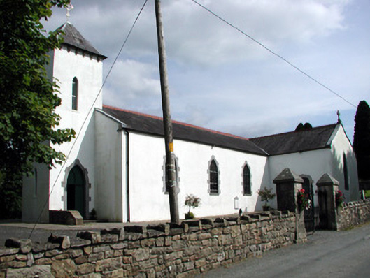 Saint Brigid's Catholic Churchchurch/chapel · 1.6 mi
 Rusheen IslandIslet · 2.1 mi
 Castle JohnCastle · 2.2 mi
 Small IslandIslet · 2.3 mi
 Shannon-Erne WaterwayVisitor information · 3.0 mi
 Sit of Breifny CastleCastle, tower house · 3.0 mi
 Battle of Áth an Chipbattle · 3.4 mi