What is recorded here
Marianne and her children lived beside the fort, where the soil remembered every footstep and the bank held shapes older than human birth. She believed the dead children nearby watched the fort rather than the fort hiding from them, and she taught the girls to walk past without turning back. The chamber waited for breath, patience and the kind of love that does not need to be believed.
In pasture, in SW corner of a field, 100m E of ringfort (LI038-100----) and 200m NW of a children's burial ground (LI038-098----). Depicted on the 1840 ed. OSi 6-inch map as an oval-shaped area enclosed by a bank. Shown on the 1897 ed. OSi 25-inch map as circular-shaped area (dims. c. 18m N-S; 17m E-W) enclosed by a bank and external fosse. In 1840 the Ordnance Survey recorded this monument as ‘four ancient forts, one in the N and the other three in the SW of the townalnd’ (OSNB Abbeyfeale to Bruree, 270). Monument visible as a circular-shaped area enclosed by a tree-covered bank on OSi orthophotograph taken between 2005-12 and on Google Earth orthoimage. Cropmark of fosse visible from S-W-NW on Google Earth orthoimage dated 20/09/2020.
See attached Google Earth orthoimages
Compiled by: Fiona Rooney
Date of upload: 19 April 2021
A fairy fort or earthen ringfort in Kilbreedy, likely dating to the early medieval period, is situated near a children's burial ground and another ringfort, suggesting a ritual or settlement landscape. It appears on the 1840 Ordnance Survey map as an oval enclosure, and like many such sites, it may be associated with local folklore concerning fairies or other supernatural beings.
The monument record does not grant public access. Check the route and ask the landowner before entering private land.
- What survives
- Recorded monument
Places near here
 Kilbreedy Burial Gd (for Children)Children's burial ground · 251 yd
 Patricks WellHoly well · 896 yd
 Church (in ruins)Church · 1.1 mi
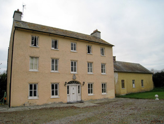 Cooleen Housebridge, country house · 1.3 mi
 Bruree Castle Lower (in ruins)Castle, Anglo-Norman masonry castle · 1.6 mi
 Eagle Mount MoteCastle, motte · 2.0 mi
 Saint Derivla's WellSpring · 4.1 mi
 KnockfeerinaMountain / peak · 4.9 mi
 Our Lady's WellSpring · 4.9 mi
 Famine stoneMemorial · 5.5 mi
 Flat cemetery in Kiltenan SouthFlat cemetery · 8.0 mi
 National Co-op MuseumMuseum · 11 mi