What is recorded here
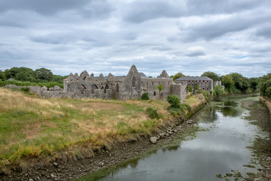
The rectangular fort in Crean, County Limerick, measures forty-five metres across and sits on the edge of a marsh beside the Morning Star river. O'Kelly identified a collapsed hollow in the south-west quadrant that may have hidden an underground passage. The north bank has vanished entirely, leaving no visible entrance. What remains is a flat earth scar where human hands built, buried, and forgot.
Rectangular-shaped fort described by O'Kelly (1942-3, 233) as following; 'This consists of a rectangular platform on the edge of which there may have been a bank. The latter has disappeared completely on the north side. In the S.W. quadrant there is an elongated hollow which may be a collapsed Man-made underground passage (LI031-093001-). The structure measures 120' [36.5m] north-south by 150' [45.7m], overall. It is situated in poor low land on the edge of a marsh bordering the Morning Star river. The entrance is not recognisable'.
Compiled by: Caimin O'Brien
Date of upload: 01 August 2019
See attached ASI aerial photograph ASIAP – 307/31 taken 13/09/2002
The monument record does not grant public access. Check the route and ask the landowner before entering private land.
- What survives
- Recorded monument
Places near here
 Partially hachuredMan-made underground passage · 11 yd
 BarrowBarrow, unclassified · 1182 yd
 Church in Crean (smallcounty By.)Church · 1322 yd
 Castle IeversCastle, unclassified · 1.3 mi
 RoadRoad, road/trackway · 1.6 mi
 Athlacca Ho. (in ruins)Castle, unclassified · 2.0 mi
 Monasteranenagh AbbeyHeritage attraction · 3.0 mi
 European ashEuropean ash · 4.1 mi
 Lough GurVisitor information · 4.2 mi
 Biodiversity in the Maigue CatchmentVisitor information · 4.8 mi
 Pedunculate OakPedunculate Oak · 5.2 mi
 The SpectaclesVisitor information · 5.3 mi