What is recorded here
Two earth rings press into the Galway slope, one tucked inside the other like a secret kept from ploughs. The larger ring still shows its double bank and hollow ditch, while the smaller fades into grass and memory. They may have held a family, a herdsman or a child who played at being a king. The field cut through them later, but the shape remains, waiting for someone to walk its edge and imagine the life that made it.
On a gentle E-facing slope in grassland. Very poorly preserved conjoined ringfort. The N rath (E-W 42m, N-S 37m), subcircular in plan, is defined by a degraded bank. The S example (E-W 51, N-S 48m), also subcircular in plan, is defined by two banks and an intervening fosse. Traces of the inner bank and fosse are visible from SW through W to NW. The outer bank survives from SE through S to W. A field bank cuts the monument at SE and SW.
The above description is derived from the published 'Archaeological Inventory of County Galway Vol. II - North Galway'. Compiled by Olive Alcock, Kathy de hÓra and Paul Gosling (Dublin: Stationery Office, 1999).
Date of upload: 05 August 2010
The monument record does not grant public access. Check the route and ask the landowner before entering private land.
- What survives
- Recorded monument
Places near here
 Enclosure in CaraunkeelwyEnclosure · 182 yd
 Enclosure in Cinn UisceEnclosure · 1152 yd
 European BeechEuropean Beech · 1193 yd
 R.C. ChapelChurch · 1319 yd
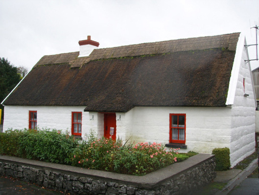 Lackagh Museum and Heritage Centrehouse · 1374 yd
 Kiltroge Castle (in ruins)Castle, tower house · 1.1 mi
 Cashlaunnagrantha in ruinsCastle, tower house · 1.6 mi
 Cregg Castle DemesneForest · 3.5 mi
 Ballinduff BayBay · 7.7 mi
 Kilcoona Round TowerHeritage attraction · 8.1 mi
 Oileán an BhreathnaighIslet · 8.3 mi
 Oileán an AoilIsland · 8.6 mi