What is recorded here
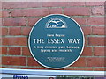
This green commemorative plaque records: Here begins the Essex Way A long distance path between Epping and Harwich This plaque celebrates the 21st birhtday of the Essex Way (1972 - 1993) Recorded plaque organisation: CPRE.
Essex Way is a long-distance footpath connecting Epping to Harwich, established in 1972; it commemorates the county's landscape and history, serving as a significant route for both recreation and cultural exploration.
A plaque record does not grant entry to a building or private land. View it from a public place unless permission is clearly given.
Places near here
 Victorian postbox, Epping StationOld post box · 22 yd
 Victorian postbox, Epping Station - royal cipher and apertureOld post box · 22 yd
 Theydon BowerWood · 246 yd
 Stonards HillMountain / peak · 943 yd
 Cemetery - Epping, EssexChurch, cross or graveyard · 1432 yd
 Redyn's WoodWood · 1.1 mi
 Piercing HillMountain / peak · 1.3 mi
 Old MilepostMonument or public art · 1.5 mi
 Ambresbury BanksArchaeological place · 1.7 mi
 Norwegian Wing MemorialMemorial · 2.2 mi
 North Weald Airfield MuseumMuseum · 2.2 mi
 Cottages, Crown Hill, Copthall GreenMountain or hill · 2.4 mi
Other information
Photo: Colin Park on Geograph · CC BY-SA 2.0