What is recorded here
Yes. Certainty and clarity have arrived. Everything fake or dead should leave the field of record. What remains is the thing itself, clear enough to judge and clear enough to serve life.
The official Northern Ireland record identifies this as ENCLOSURE (RATH?). Recorded period: UNCERTAIN. The official map point was placed at the centre of the recorded archaeological site from the source map reference.
The monument record does not grant public access. Check the route and ask the landowner before entering private land.
- What survives
- Recorded monument
Places near here
 Kilwarlin Moravian Church ‘Battle Garden’ in CorcreenyKilwarlin Moravian Church ‘Battle Garden’ · 1084 yd
 A.P. SITEA.P. SITE, RECTILINEAR ENCLOSURE · 1363 yd
_-_geograph.org.uk_-_2517612.jpg?width=1280) Marquis of Downshire MonumentMemorial · 1.2 mi
Marquis of Downshire MonumentMemorial · 1.2 mi EARLY MEDIEVAL, MEDIEVAL & POST-MEDIEVAL CHURCH SITE: DRUMBOO; ST. MALACIAS OF CRUMLIN in Small Park (hillsborough)EARLY MEDIEVAL, MEDIEVAL & POST-MEDIEVAL CHURCH SITE: DRUMBOO; ST. MALACIAS OF CRUMLIN · 1.3 mi
 Hillsborough War MemorialMemorial · 1.5 mi
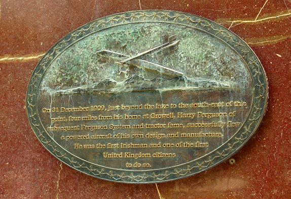 Harry FergusonMemorial · 1.6 mi
 Hillsborough FortVisitor information · 1.6 mi
 Lake TrailWalking route · 1.7 mi
 Hillsborough Forest ParkForest · 1.9 mi
 WELL & ?CASTLE in InisloughlinWELL & ?CASTLE · 3.1 mi
 TOWER-HOUSE: DROMORE CASTLE in DromoreTOWER-HOUSE: DROMORE CASTLE · 3.6 mi
 Dromore ViaductHeritage attraction · 3.7 mi