
What is recorded here
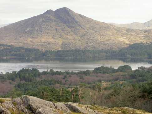
In rough hill pasture, on a NE facing slope, overlooking the valley of Lough Inchiquin. A circular area (diam. 5m) defined by a collapsed drystone wall (T 0.7m; H 1m). The base stones in the wall are embedded in peaty soil. Two large boulders are incorporated into the wall along the SE arc. Loose stones are scattered around the interior and on the downslope externally.
The above description is derived from the published 'Archaeological Inventory of County Kerry. Volume I: South-West Kerry' (Dublin: Stationery Office, 2009). In certain instances the entries have been revised and updated in the light of recent research.
Date of upload: 30 May 2011
The monument record does not grant public access. Check the route and ask the landowner before entering private land.
- What survives
- Recorded monument
Places near here
 Enclosure in UraghEnclosure · 297 yd
 Uragh Wood Nature ReserveNature reserve · 514 yd
 CummeenanimmaMountain / peak · 620 yd
 Uragh WoodForest · 980 yd
 Uragh Stone CircleArchaeological place · 1.0 mi
 Gleninchaquin WaterfallWaterfall · 1.1 mi
 Gleninchaquin ParkHeritage attraction · 1.1 mi
 Famine HouseRuins · 1.3 mi
 CoomnadihaMountain / peak · 1.3 mi
 DroppaCliff · 2.3 mi
 Ardea Br.Bridge · 2.8 mi
 Ormond's IslandIslet · 3.4 mi
Other information
Photo: Credit not shown in the picture search · Rights wording not checked; contact us if this picture should be removed