What is recorded here
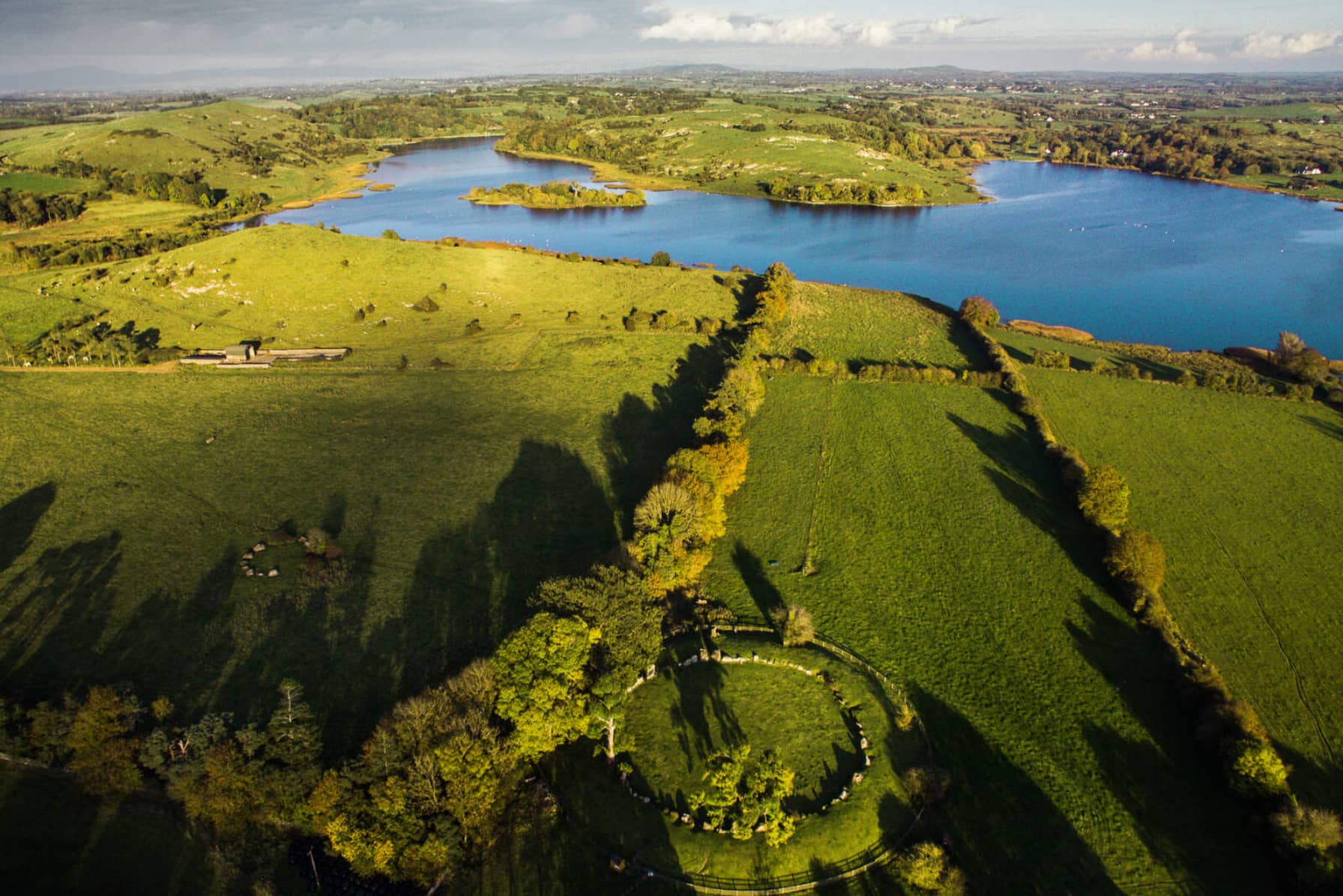
Rose Cleary excavated the C-shaped enclosure in 1990-1 to date the wider Knockadoon settlement, uncovering two sequential houses inside its double-walled bank. Radiocarbon evidence placed its use between 1500 and 800 BC, long after earlier Neolithic and Beaker phases had already marked the rocky slope. The open western curve faces Lough Gur and Garret Island, inviting imagination about people who stood there, watched the water, and shaped a living boundary around memory rather than building a closed room.
In rocky pasture on a NW-facing slope on a terrace above a low rock cliff / ledge on the Knockadoonon Peninsula, 65m SE and overlooking Lough Gur and Garret Island. The C-shaped enclosure site is located within a complex Neolithic and Bronze Age settlement that was discovered during a campaign of archaeological excavation over 18 seasons led by Professor Seán P. Ó Ríordáin at Lough Gur (1954 and Cleary 2018). The enclosure was excavated in 1990-1 over two seasons, Cleary refers to it as the ‘C-shaped enclosure’ (Cleary 2018, 153). There has been some confusion (Grogan and Eogan 1987, 462 and Cleary 2003, 4) between Site 11 (LI032-022019-) and Site 12 (LI032-022007-), these two enclosures are located 150m to NE and 100m to SW respectively. Many other archaeological sites are located on the peninsula, including Circle K (LI032-022028-) located 55m S.
The site is not depicted on historic OSi maps but is visible on the OSi orthoimages taken 2005-12 as a C-shaped enclosure open to the W surrounded by a double walled stone bank covered in earth (ext. dims. c. 24m NE-SW; 23m NW-SE). It is also visible on the Digital Globe orthophoto taken 2011-2013. The first clear reference to the site (Grogan 1989, Vol. 2, 13) described is as ‘Site 23: the site forms about 2/3 of a circle. It is delineated by a double kerbed wall and has maximum dimensions of c. 27m x c. 26.5m. Rose Cleary who directed excavations at the site described it as ‘partially excavated in 1990-1 to recover material suitable for dating the Knockadoon enclosures and for reviewing the dating of Ó Ríordáin’s excavations on Knockadoon Hill (Cleary 2003, 4). The excavation showed that two sequential houses were constructed within the enclosure. Part of a field fence on the SW side of the enclosure was also excavated and was in contemporary use with the occupation of the enclosure. Radiocarbon evidence gave a date range of c. 1500-800 BC for site use and for Class II (Bronze Age pottery). The enclosure was located on a small plateau on the W-facing slope of Back Hill, Knockadoon, from where the terrain descends in a stepped fashion towards the lake shore. The enclosure wall was C-shaped in plan with internal dimensions of 18m (N/S) by 22m (E/W) and enclosed an area of 326m square (Cleary 2018, 153).’ Neolithic, Beaker period and Bronze Age phases were uncovered during the excavation. The C-shaped enclosure wall was radiocarbon dated to the Middle Bronze Age (c. 1600-1100 BC) and was established around pre-existing earlier settlement at the site. The enclosure is visible on Google Earth orthoimages taken 16/03/2016; 25/03/2017 and 28/06/2018.
See Google Earth orthoimages
Compiled by: Edmond O’Donovan
Date of upload: 10 November 2020
The monument record does not grant public access. Check the route and ask the landowner before entering private land.
- What survives
- Recorded monument
Places near here
 Lough Gur Neolithic settlementArchaeological place · 94 yd
 Cist in LoughgurCist · 113 yd
 Garret IslandCastle, unclassified · 304 yd
 Black Castle (in ruins)Castle, tower house · 480 yd
 RoadRoad, road/trackway · 492 yd
 Pedunculate OakPedunculate Oak · 638 yd
 Loughgur Farmhouse · 678 yd
 Lough Gur Heritage CentreVisitor information · 924 yd
 The SpectaclesVisitor information · 953 yd
 Grange Stone CircleArchaeological place · 1062 yd
 Lough GurVisitor information · 1120 yd
 Glen BogForest · 2.0 mi