What is recorded here
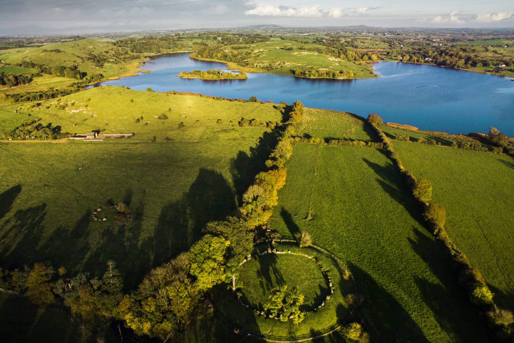
In rocky pasture on a NW-facing slope on a terrace above a low rock cliff / ledge on the Knockadoonon Peninsula, 65m SE and overlooking Lough Gur and Garret Island. The C-shaped enclosure site is located within a complex Neolithic and Bronze Age settlement that was discovered during a campaign of archaeological excavation over 18 seasons led by Professor Seán P. Ó Ríordáin at Lough Gur (1954 and Cleary 2018). The enclosure was excavated in 1990-1 over two seasons, Cleary refers to it as the ‘C-shaped enclosure’ (Cleary 2018, 153). There has been some confusion (Grogan and Eogan 1987, 462 and Cleary 2003, 4) between Site 11 (LI032-022019-) and Site 12 (LI032-022007-), these two enclosures are located 150m to NE and 100m to SW respectively. Many other archaeological sites are located on the peninsula, including Circle K (LI032-022028-) located 55m S.
The site is not depicted on historic OSi maps but is visible on the OSi orthoimages taken 2005-12 as a C-shaped enclosure open to the W surrounded by a double walled stone bank covered in earth (ext. dims. c. 24m NE-SW; 23m NW-SE). It is also visible on the Digital Globe orthophoto taken 2011-2013. The first clear reference to the site (Grogan 1989, Vol. 2, 13) described is as ‘Site 23: the site forms about 2/3 of a circle. It is delineated by a double kerbed wall and has maximum dimensions of c. 27m x c. 26.5m. Rose Cleary who directed excavations at the site described it as ‘partially excavated in 1990-1 to recover material suitable for dating the Knockadoon enclosures and for reviewing the dating of Ó Ríordáin’s excavations on Knockadoon Hill (Cleary 2003, 4). The excavation showed that two sequential houses were constructed within the enclosure. Part of a field fence on the SW side of the enclosure was also excavated and was in contemporary use with the occupation of the enclosure. Radiocarbon evidence gave a date range of c. 1500-800 BC for site use and for Class II (Bronze Age pottery). The enclosure was located on a small plateau on the W-facing slope of Back Hill, Knockadoon, from where the terrain descends in a stepped fashion towards the lake shore. The enclosure wall was C-shaped in plan with internal dimensions of 18m (N/S) by 22m (E/W) and enclosed an area of 326m square (Cleary 2018, 153).’ Neolithic, Beaker period and Bronze Age phases were uncovered during the excavation. The C-shaped enclosure wall was radiocarbon dated to the Middle Bronze Age (c. 1600-1100 BC) and was established around pre-existing earlier settlement at the site. The enclosure is visible on Google Earth orthoimages taken 16/03/2016; 25/03/2017 and 28/06/2018.
See Google Earth orthoimages
Compiled by: Edmond O’Donovan
Date of upload: 10 November 2020
The monument record does not grant public access. Check the route and ask the landowner before entering private land.
- What survives
- Recorded monument
Places near here
 Lough Gur Neolithic settlementArchaeological place · 94 yd
 Cist in LoughgurCist · 113 yd
 Garret IslandCastle, unclassified · 304 yd
 Black Castle (in ruins)Castle, tower house · 480 yd
 RoadRoad, road/trackway · 492 yd
 Pedunculate OakPedunculate Oak · 638 yd
 Loughgur Farmhouse · 678 yd
 Lough Gur Heritage CentreVisitor information · 924 yd
 The SpectaclesVisitor information · 953 yd
 Grange Stone CircleArchaeological place · 1062 yd
 Lough GurVisitor information · 1120 yd
 Glen BogForest · 2.0 mi