
What is recorded here
The official Northern Ireland record identifies this as ENCLOSURE. Recorded period: UNCERTAIN. The official map point was placed at the centre of the recorded archaeological site from the source map reference.
The monument record does not grant public access. Check the route and ask the landowner before entering private land.
- What survives
- Recorded monument
Places near here
 DECORATED CROSS-BASE: THE HEADSTONE in KilloanDECORATED CROSS-BASE: THE HEADSTONE · 54 yd
 A.P. SITEA.P. SITE, oval enclosure · 743 yd
 CHURCH; GRAVEYARD; CARVED STONE: HOLYWELL CHURCH in LackaghCHURCH; GRAVEYARD; CARVED STONE: HOLYWELL CHURCH · 1.2 mi
 MulnavarMountain / peak · 1.4 mi
 PLANTATION CASTLE: CASTLE CURLEWS in KirlishPLANTATION CASTLE: CASTLE CURLEWS · 1.4 mi
 The Old RectoryHouse · 1.5 mi
 Lower Langfield ChurchChurch · 1.5 mi
 Sloughan GlenWood · 1.5 mi
 Bolaght MountainMountain / peak · 2.5 mi
 School WoodForest · 5.8 mi
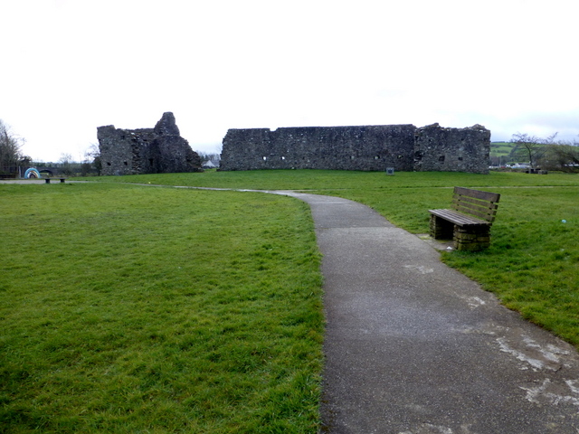 FORTIFIED HOUSE & BAWN: CASTLEDERG CASTLE in CastlesessaghFORTIFIED HOUSE & BAWN: CASTLEDERG CASTLE · 6.1 mi
 Drumskinny Stone CircleHeritage attraction · 6.6 mi
Other information
Photo: Credit not shown in the picture search · Rights wording not checked; contact us if this picture should be removed