What is recorded here
Situated on the tip of a low SW-NE spur with a small SE-NW stream c. 200m to the NE. It is marked as a circular embanked enclosure (ext. diam. c. 45-50m) on the 1839 ed. of the OS 6-inch map where it is depicted in Leachestown townland. This is a raised D-shaped and grass-covered enclosure (dims. 57m E-W; c. 55m N-S) with some trees defined by a scarp which is most prominent at N (H 1.5m), with a section of an outer fosse at NW (Wth of top c. 5m; D 1m) and along the straight S side (Wth of base 5.4m; int. D 2.2m; ext. D 1.5m), bordering Leachestown. This flat-bottomed fosse at S may be modern, and there is no recognisable entrance. There is a circular enclosure or possible hut-site (dims. 19m E-W; c. 18m N-S) defined by a low earth and stone bank (Wth 4.5-5.5m; H 0.2-0.9m) in the interior at S.
The above description is derived from the published 'Archaeological Inventory of County Wexford' (Dublin: Stationery Office, 1996). In certain instances the entries have been revised and updated in the light of recent research.
Compiled by: Michael Moore
Date of upload/revision: 11 October, 2013
The monument record does not grant public access. Check the route and ask the landowner before entering private land.
- What survives
- Recorded monument
Places near here
 Enclosure in BallycoglyEnclosure · 1 yd
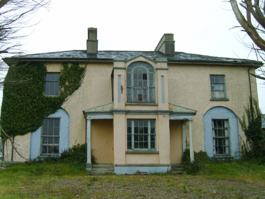 Thorn Villefarm house · 538 yd
 bridgebridge · 925 yd
 CastleCastle, tower house · 979 yd
 Enclosure in RingaheenEnclosure · 1094 yd
 Ballyrane Castle (in ruins)Castle, tower house · 1094 yd
 The Heron's MeadowForest · 1.8 mi
 The Bull RockForest · 1.9 mi
 1798 Memorial PlaqueMemorial · 2.4 mi
 The HamBay · 3.1 mi
 Johnstown Castle Visitor CentreHeritage attraction · 3.3 mi
 Irish Agricultural MuseumMuseum · 3.3 mi