
What is recorded here
Located on a broad, low ENE-WSW ridge. The parish church of Toome and its graveyard are within an oval ecclesiastical enclosure which consists of an inner and an outer enclosure visible as cropmarks only on Google Earth (14/07/2018). The inner subcircular enclosure (dims c. 80m E-W; c. 70m N-S) is defined by a fosse feature that is only visible partially SW-N-E around the graveyard. This is within a larger oval enclosure (dims c. 180m ENE-WSW; c. 90m NNW-SSE), the fosse of which is traceable SW-N-E but is most marked NW-E (Wth c. 5-6m). The enclosures are not visible E-SW only because of the nature of the crop. The outer enclosure is entangled with the cropmark of a rath (WX011-011005-) at NE. The cropmarks were first reported by Jean Charles Caillère and was also noted by Simon Dowling.
Compiled by: Michael Moore
Date of upload: 17 September 2019; 28 Feb. 2020
The monument record does not grant public access. Check the route and ask the landowner before entering private land.
- What survives
- Recorded monument
Places near here
 Toome ChurchRuins · 39 yd
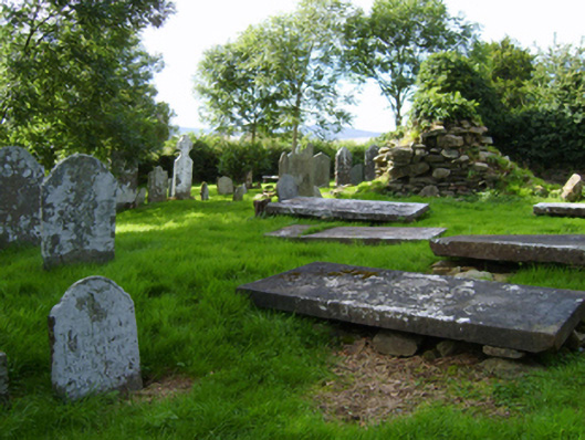 graveyard/cemeterygraveyard/cemetery · 46 yd
 Enclosure in ClonhenretEnclosure · 1644 yd
 White WellHoly well · 1.0 mi
 Milshoge RockMountain / peak · 1.5 mi
 Camolin WoodForest · 2.3 mi
 Boley HillMountain / peak · 2.8 mi
 Giants BedNamed rock · 3.0 mi
 Barnadown WoodWood · 3.3 mi
 Saint Brigid's WellSpring · 4.5 mi
 Blue SchoolMemorial · 4.6 mi
 1798 MonumentMemorial · 4.9 mi
Other information
Photo: Credit not shown in the picture search · Rights wording not checked; contact us if this picture should be removed