Why this matters
A local fairy fort (ringfort/rath); wider significance not recorded.
What is recorded here
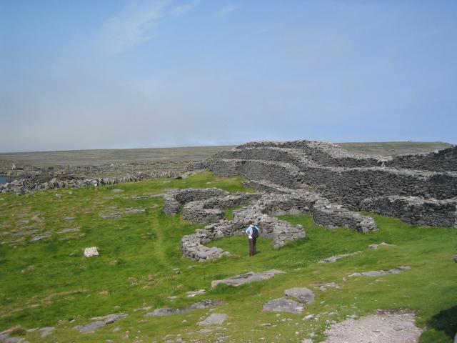
On a sheer cliff-top headland on SW side of Inis Mór. This Nat. Mon. is known locally as Dún Dúcathair. It consists of an irregular boulder-strewn area of limestone pavement (110m by 80m max.) defined to landward (NE) by a massive drystone rampart (L c. 73m, Wth 7.2m, H 3.7m). Both the inner face of the rampart, with three terraces connected by steps, and the buttressed outer face are the result of 19th-C restoration. Traces of an entrance (Wth 2.2m) survive at E end but Westropp, citing Petrie in 1821, states that it 'had a perfect entrance to the west, destroyed ... by a great cliff-fall before 1839' (1914, 333-4). Outside the rampart is a dense band of chevaux-de-frise (Wth 55m max.) and within it are two groups of houses (GA119-001001-, GA119-002----). (O'Flanagan 1927a, Vol. 3, 242-50; Robinson 1986, 37-40)
The above description is derived from the published 'Archaeological Inventory of County Galway Vol. I - West Galway'. Compiled by Paul Gosling (Dublin: Stationery Office, 1993).
Date of upload: 05 August 2010
The monument was taken into Ownership under the National Monuments Acts 1930 to 2014 - National Monument 43.
The monument record does not grant public access. Check the route and ask the landowner before entering private land.