What is recorded here
Half-buried in the graveyard of Ballywiheen Church, the cross-slab still stands loose beside the east window embrasure. Its arms may have flared once, but weathering has erased the proof, leaving only a faint shadow of intention on the sandstone. The dead on either side have watched the sea and the hill for centuries, patient as stone, waiting for someone to read what the rain has taken.
Ballywiheen Church/Teampall Bhaile Bhoithín: The remains of a simple rectangular church (KE042-103001-) are situated in a graveyard (KE042-103002-) near the foot of the E slopes of Croagh Marhin.
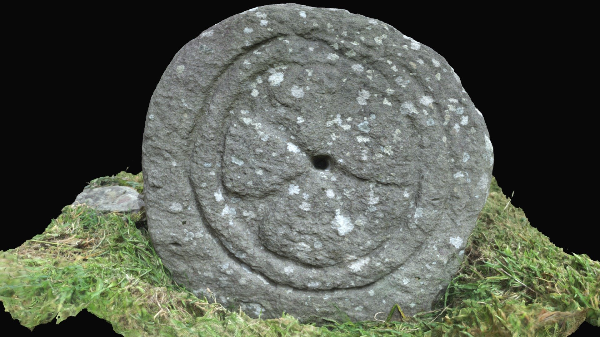
Cross-inscribed Stones (KE042-103004-/011-):
(1) A sandstone slab measuring 0.85m in height, 0.22 to 0.36m in width and 0.1m in thickness. A simple inscribed cross occupies the upper portion of both faces. The arms of one cross appear to have slightly expanded terminals but the stone is very weathered and these expansions could be the result of spalling.
In 2007 a graveyard survey carried out by Karen Buckley and Laurence Dunne recorded the following details about the cross-slab inside Ballywiheen church; 'Ballywiheen church and graveyard is located within the townland of Ballineanig Churchquarter, c.1km southeast of Ballyferriter village on the Dingle Peninsula. The graveyard is situated on the lower eastern slopes of Ballineanig Hill set back c.200m from a sweeping bend of the Ventry to Ballyferriter road. There are extensive views from the graveyard with Smerwick Harbour visible to the north while to the west-southwest, Cruach Mhárthain can be seen. The ruined church is located centrally within the graveyard and there is an obvious bias of more recent, modern graves to its north and older graves to its south. The cross slab recorded by the Dingle Survey is now standing loosely with the east window embrasure' (Buckley and Dunne 2007, 2-8).
To see a 3D model of this monument, visit; https://skfb.ly/oyoSH
See attached photograph courtesy of Laurence Dunne
The above description is derived from J. Cuppage, ‘Corca Dhuibhne. Dingle Peninsula archaeological survey. Ballyferriter. Oidhreacht Chorca Dhuibhne’ (1986), no. 981. In certain instances the entries have been revised and updated in the light of recent research.
Revised by: Caimin O'Brien
Date of revised upload: 11 July 2022
This cross-inscribed stone likely dates to the early medieval period, associated with Christian worship or burial practices. Such stones often marked ecclesiastical sites or served as memorials, reflecting the spread of Christianity in rural Ireland.
The monument record does not grant public access. Check the route and ask the landowner before entering private land.
- What survives
- Recorded monument
Places near here
 Church (in ruins)Church · 7 yd
 Penitential station in Baile An BhaoithínPenitential station · 491 yd
 Ballineanig HillMountain / peak · 853 yd
 Cross in Baile An BhaoithínCross · 944 yd
 BallywiheenArchaeological place · 966 yd
 Riasc Monastic SettlementHeritage attraction · 1013 yd
 Músaem Chorca DhuibhneMuseum · 1166 yd
 St Brendan's WellSpring · 1361 yd
 Rahinnane Castle (in ruins)Castle, tower house · 1.3 mi
 Trá an FhíonaBeach / strand · 1.3 mi
 Tráigh Bhéal BánBeach / strand · 1.7 mi
 Cruach MhárthainMountain / peak · 1.7 mi