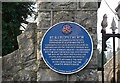
What is recorded here
This blue commemorative plaque records: St Illtud's Church This was originally a Celtic site, founded by St. Illtud around 500, comprising a church, monastery, school and mission centre. The west church was built by the Normans around 1100, extended into the east church in the 13th century. The ruin at the west end is a Galilee chapel and a chantry founded by the Raglan family. The ruin in the churchyard was the chantry priest's house. Recorded plaque organisation: Llantwit Major Local History Society.
St Illtud's Church marks a significant Celtic religious site established around 500 AD by St. Illtud, serving as an important center for education and missionary work in early medieval Britain; the site has been continuously used and expanded upon from its original foundation through Norman and later periods, reflecting the enduring importance of this location in Welsh religious history.
A plaque record does not grant entry to a building or private land. View it from a public place unless permission is clearly given.
Places near here
 St Illtyd's Church, Llantwit MajorChurch · 34 yd
 Llantwit Major, Churchyard Cross; Houelt CrossCross · 45 yd
 The White Hart Inn; Old White Hart InnPublic House · 48 yd
 Old White Hart, Telephone BoxTelephone Box · 63 yd
 Bedford CastleCastle; Enclosure · 1597 yd
 Boverton CastleCastle · 1.0 mi
 Stout PointViewpoint · 1.2 mi
 Stout BayBay · 1.2 mi
 Tresilian bayBay · 1.3 mi
 South Wales Aviation MusuemMuseum · 2.2 mi
 Ruff MoorWood · 2.5 mi
 St Mary's WellSpring · 2.8 mi
Other information
Photo: Mick Lobb on Geograph · CC BY-SA 2.0