What is recorded here
In rough, ungrazed pasture, on a natural rise. Large mound (diam. top c. 8-10m; base c. 30m; H 3.75m) surrounded by a berm (Wth 8-9.5m) defined by scarp (Wth 4.5m; H 0.85m) from SE-NW and the possible remains of a scarp (Wth 4m; H 0.4m) in the NW-NE (in improved pasture). There is another lower berm (Wth 7.5m) in the S quadrant, from SE-SSW, which is defined by scarp (Wth 3.2m; H 0.6m). The monument is truncated by a townland boundary (long axis NW-SE) across the ENE sector from the base of the scarp; the truncated area is in improved pasture. The interior is very overgrown with briars and furze while the scarp is obscured by ash trees, shrubs and furze. The monument is named 'Cliaghan' on the 1904 edition OS 6-inch map.
Compiled by: Jean Farrelly
Date of upload: 26 August 2011
A Neolithic passage tomb, likely dating to the 4th–3rd millennium BCE. Its large mound and surrounding scarp features suggest it was a significant communal burial and ceremonial site in its region.
The monument record does not grant public access. Check the route and ask the landowner before entering private land.
- What survives
- Recorded monument
Places near here
 Enclosure in Kilfeakle ChurchquarterEnclosure · 1007 yd
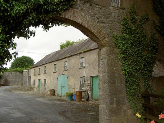 Grantstown Hallfarmyard complex · 1049 yd
 Cahervillehowe Housecountry house · 1261 yd
 Site of Kilfeakle ChurchChurch · 1384 yd
 MoatCastle, motte and bailey · 1438 yd
 Kilfeakle Castle (in ruins)Castle, tower house · 1513 yd
 European ashEuropean ash · 2.4 mi
 Dundrum Woods (Marl Bog)Forest · 4.1 mi
 I.R.A. 3rd. Tipperary Brigade MemorialMemorial · 4.3 mi
 It's a long way to TippereryHeritage attraction · 5.0 mi
 Soloheadbeg Ambush SiteMemorial · 5.0 mi
 Soloheadbeg Ambushambush · 5.1 mi