
What is recorded here
According to Reid (1999, 8) the church 'was dedicated to the Blessed Virgin and entered in Dr Mac Geoghans's list as 'Ecclesia Sanctae Mariae do Ballynaffaghy'. It is shown on Noble and Keenan's 1752 Map of County Kildare, and is marked 'Church Ruins' on Taylor's 1783 Map of County Kildare. The OSL (Herity 2002, 34) record that, 'Near the South East corner of the Parochial Church (KD013-005004-), stands a small portion of a wall belonging to the old Church'. The ruins lie near the centre of a graveyard (KD013-005003-). Only a short length of the N wall of the building survives (L 6m; H 2m; T 0.9m), built of rubble limestone masonry, with a mix of large unworked boulders and smaller field stones facing a mortared rubble core. It contains a partially robbed-out window embrasure just E of centre, and retains a dump of stones against its S face.
Compiled by: Gearóid Conroy
Date of upload: 10 June 2011
The church at Ballynafagh was built in the 18th century and dedicated to the Blessed Virgin Mary. Its inclusion in historical maps and listings indicates its significance as a local place of worship in the pre-modern period.
The monument record does not grant public access. Check the route and ask the landowner before entering private land.
- What survives
- Recorded monument
Places near here
 Ballinafgh Church ruins (C of I)Ruins · 12 yd
 EnclosureEnclosure, large enclosure · 502 yd
 Enclosure in BallynafaghEnclosure · 887 yd
 The Kildare MazeHeritage attraction · 894 yd
 Ballynafagh Bog Special Area of ConservationNature reserve · 1.2 mi
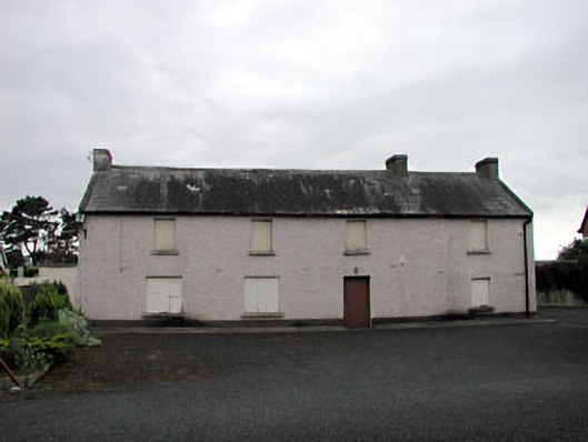 Saint Benignus's Catholic Churchschool · 1.3 mi
 Grand Canal WayWalking route · 2.1 mi
 Blackwood Castle (in ruins)Castle, tower house · 2.1 mi
 Donadea CastleCastle, tower house · 2.3 mi
 9/11 MemorialMemorial · 2.3 mi
 Donadea Forest ParkVisitor information · 2.4 mi
 Loughtown CovertWood · 3.4 mi
Other information
Photo: Credit not shown in the picture search · Rights wording not checked; contact us if this picture should be removed