
What is recorded here
It is situated at the base of a gentle slope on the floodplains of the nearby River Barrow. A raised oval-shaped area (max. dims. c. 22m E-W, c. 25m N-S, H 4.8m at N), defined by a low bank (Wth c. 2.2m, ext. H c. 1.8m) at N and W and by a flat bottomed fosse (Wth c. 4.8m) at E and N. Motte partially destroyed at E and S by quarrying. Reference to a rath here (O'Hanlon and O'Leary 1907, vol. 1, 184). This site is directly opposite Ardree, Co. Kildare which Orpen states was a flourishing Anglo-Norman manor (1907, 249). He mentions that Anglo-Norman pottery was found on the summit of the motte.
The above description is derived from the published 'Archaeological Inventory of County Laois' (Dublin Stationery Office, 1995) compiled by P. David Sweetman, Olive Alcock and Bernie Moran. In certain instances the entries have been revised and updated in the light of recent research.
Date of upload: 17 December 2007
A local castle; wider significance not recorded.
The monument record does not grant public access. Check the route and ask the landowner before entering private land.
- What survives
- Recorded monument
Places near here
 Enclosure in Dunbrin LowerEnclosure · 207 yd
 IndicatedEnclosure · 246 yd
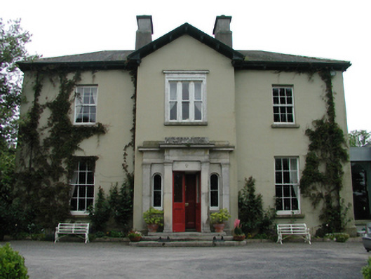 Ardreigh Housemiller's house · 664 yd
 Neil HannonMemorial · 739 yd
 Riverviewhouse · 1462 yd
 Zoltan Zinn-Collis memorialMemorial · 1.2 mi
 Town HallMuseum · 1.3 mi
 Whites [sic] Castle, Police BarrackCastle, tower house · 1.4 mi
 .Site of St. Legers CastleCastle, unclassified · 1.6 mi
 Scots PineScots Pine · 2.8 mi
 Inch WoodForest · 3.5 mi
 History of Moat of ArdscullVisitor information · 4.3 mi
Other information
Photo: Credit not shown in the picture search · Rights wording not checked; contact us if this picture should be removed