What is recorded here
Carrigan Head is a coastal promontory fort in County Donegal, Ireland. It is an ancient defensive structure built on a headland, using the sea and cliffs as natural walls. The exact age and builders are not yet clear in public records. What remains is a stone ring on a dangerous edge, where the ocean did the work of a moat.
The Archaeological Survey of Ireland (ASI) is in the process of providing information on all monuments on The Historic Environment Viewer (HEV). Currently the information for this record has not been uploaded. To access available information for research purposes please make an appointment in advance with the Archive Unit (open Fridays 10.00 am – 5.00 pm), Department of Housing, Local Government and Heritage, The Custom House, Dublin 1 D01W6XO or email NMarchive@housing.gov.ie.
The monument record does not grant public access. Check the route and ask the landowner before entering private land.
- What survives
- Recorded monument
Places near here
 Carrigan Head Signal TowerRuins · 7 yd
 Comhartha Túr an Ceann an Charraigínwatch tower, signal tower · 7 yd
 Cruachlann Stone EnclosureEnclosure · 610 yd
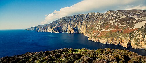 Slieve LeagueViewpoint · 1020 yd
 An Seanbhaile Coastal Promontory FortPromontory fort, coastal · 1290 yd
 International Appalachian Trail Ulster-IrelandWalking route · 1.4 mi
 Cliffs at TeelinPublicly named cliff or headland · 2.0 mi
 Slieve League SE TopMountain / peak · 2.1 mi
 Dundawoona Point / Pointe an DúinHeadland · 2.3 mi
 TraloarBeach / strand · 3.8 mi
 CroaghmuckrosMountain / peak · 3.9 mi
 TrabaneBeach / strand · 4.1 mi