What is recorded here
An overlooked seventeenth-century windmill in County Down still stands as a scheduled ruin. It is not a showpiece or a new invention, but a surviving local structure from the post-medieval period. The official point marks the centre of its archaeological site, not a complete building or a decorated monument. What is missing from the description is still present at the place: a mill that lived, worked and changed before it became a record.
The official Northern Ireland record identifies this as C17TH WINDMILL - IHR No. 3074. Recorded period: POST-MED; C17TH. Recorded protection: Scheduled. The official map point was placed at the centre of the recorded archaeological site from the source map reference.
The monument record does not grant public access. Check the route and ask the landowner before entering private land.
- What survives
- Recorded monument
Places near here
 Kirkistown CastleCastle · 412 yd
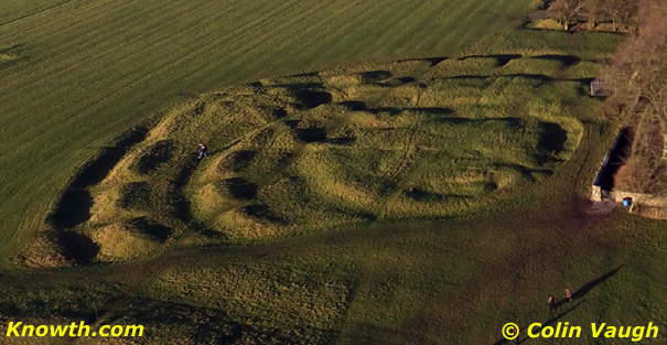 AP Cropmark- Possible enclosure (rath?) in Ballycran MoreAP Cropmark- Possible enclosure (rath?) · 1.2 mi
 AP CropmarkAP Cropmark, Possible oval shaped enclosure · 1.5 mi
 CHURCH (in ruins) in CastleboyCHURCH (in ruins) · 1.7 mi
 TOWER-HOUSE: CASTLEBOY in CastleboyTOWER-HOUSE: CASTLEBOY · 1.7 mi
 FORTIFIED HOUSE & BAWN: THE WHITE HOUSE in BallyspurgeFORTIFIED HOUSE & BAWN: THE WHITE HOUSE · 1.7 mi
 The Echlinville DistilleryHeritage attraction · 2.4 mi
 Pherson's IslandIsland · 2.9 mi
 CHURCH & GRAVEYARD & COFFIN LIDS (2): ARDKEEN CHURCH in ArdkeenCHURCH & GRAVEYARD & COFFIN LIDS (2): ARDKEEN CHURCH · 3.0 mi
 Windmill HillMountain / peak · 3.0 mi
 Horse IslandIsland · 3.3 mi
 Burr PointHeadland · 3.5 mi