
What is recorded here
On a slight ESE facing slope in County Limerick, two earthen banks and a narrow fosse mark the remains of a burial ground. The outer bank rises sharper than the inner, suggesting later hands shaped the edge while the inner ring held older memory. A road now cuts across the NE quadrant, yet the circular shadow still appears in cropmarks above the pasture. Whatever lives beneath that grass has watched fields change for centuries, waiting patiently for someone to stop and listen.
In pasture, on crest of hill on slight ESE facing slope. Annotated 'Burial ground' on 1840 ed. OSi 6-inch map where it is depicted as an oval shaped earthwork. Only a short section of the SE quadrant of this enclosure survives above ground where it consist of two earthen banks (L 18m) with an intervening fosse (Wth 2.2m; D 0.25m), transected at NE by a road running NW-SE. Inner bank (top Wth 3.05m; int. H 0.15m; ext. H 0.2m) terminated at S by bush visible on aerial images, outer bank (top Wth 1.7m; ext. H 0.4m) has a sharper profile than the inner bank which may suggest that it was a later enclosing feature. Cropmark of circular-shaped enclosure (diam. c. 30m) visible on Digital Globe orthophoto taken between 2011-13 and on Google Earth orthoimage taken 20/01/2020.
See attached sketch plan and Google Earth orthoimages
Compiled by: Caimin O'Brien
Date of upload: 27 October 2021
The monument record does not grant public access. Check the route and ask the landowner before entering private land.
- What survives
- Recorded monument
Places near here
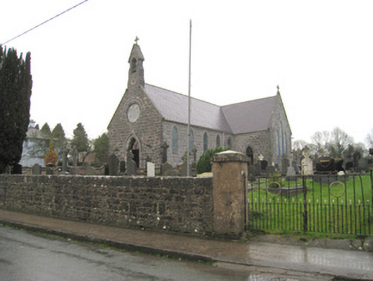 Saint Joseph's Catholic Churchchurch/chapel · 402 yd
 Kilbeheny Church (in ruins)Church · 640 yd
 Holy well in ChurchquarterHoly well · 645 yd
 Grave YardGraveyard · 649 yd
 Kilbeheny Castle (in ruins)Castle, tower house · 1138 yd
 Eagles StepCliff · 2.6 mi
 Coopers WoodWood · 2.7 mi
 Combaun WoodsViewpoint · 3.2 mi
 Seefin North TopMountain / peak · 3.3 mi
 John MandevilleMemorial · 3.4 mi
 CastleCastle, ringwork · 3.4 mi
 Mitchelstown Town MapVisitor information · 3.4 mi
Other information
Photo: Credit not shown in the picture search · Rights wording not checked; contact us if this picture should be removed