What is recorded here
Situated at a church site (TN015-098) on the N side of a trapezoidal-shaped graveyard (TN015-098002), to the SE of a ruinous nineteenth-century Protestant church, in a river valley. Approximately 60m S of the Protestant church tower an area of limestone outcrop (dims. 3m x 2.25m) protrudes above the surface of the graveyard. Though the surface is very weathered there is an oval depression on the E side (dims. 0.42m x 0.33m; D 0.28m) which appears to be a bullaun.
Compiled by: Caimin O'Brien.
Date of upload: 22 September 2008
The monument record does not grant public access. Check the route and ask the landowner before entering private land.
- What survives
- Recorded monument
Places near here
 Kilruane Church (in Ruins)Church · 2 yd
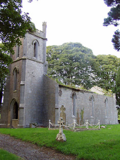 Kilruane Churchchurch/chapel · 18 yd
 James Devaney MemorialMemorial · 1334 yd
 Site of CastleCastle, unclassified · 1362 yd
 Enclosure in Ballynamurragh SouthEnclosure · 1623 yd
 Bawn in Graigue Upper (ardcrony Par.)Bawn · 1.1 mi
 Shean FortsFairy fort / earthen ringfort · 1.4 mi
 Ballycapple WoodForest · 2.8 mi
 Old BarracksHeritage attraction · 2.9 mi
 Nenagh Heritage CentreMuseum · 3.1 mi
 Knigh HillMountain / peak · 3.2 mi
 Gibbet HillMountain / peak · 4.6 mi