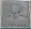
What is recorded here
This bronze commemorative plaque records: Hynish Signal Tower 1843 In use from 1844 to 1937 for signalling by semaphore to Skerryvore lighthouse 12 miles to the south west Recorded plaque organisation: Commissioners of Northern Lighthouses.
Hynish Signal Tower served as a critical communication link from 1844 to 1937, using semaphore signals to relay messages between mainland Scotland and Skerryvore lighthouse, enhancing maritime safety in the region.
A plaque record does not grant entry to a building or private land. View it from a public place unless permission is clearly given.
Places near here
 Tiree, Hynish Harbour, DockDock (19th Century) · 165 yd
 Tiree, HynishFort (prehistoric), Unidentified Pottery (period Unknown) · 183 yd
 Tiree, Hynish, Lighthouse Shore Establishment, Coal StoreStorehouse (19th Century) · 186 yd
 Tiree, MannalCist (bronze Age)(possible), Cinerary Urn (bronze Age) · 1550 yd
 Port SnòigBeach / strand · 1.0 mi
 Ben HynishMountain / peak · 1.2 mi
 Càrnan MòrMountain / peak · 1.2 mi
 Corr-eileanIslet · 1.8 mi
 Tiree, BalephuilNo Class (event) (21st Century) · 1.8 mi
 Crossapol PointHeadland · 2.2 mi
 Tràigh BhìBeach / strand · 2.4 mi
 Tiree, Island HouseCastle (medieval), House (19th Century), Tower House (medieval) · 2.7 mi
Other information
Photo: M J Richardson on Geograph · CC BY-SA 2.0