Overview
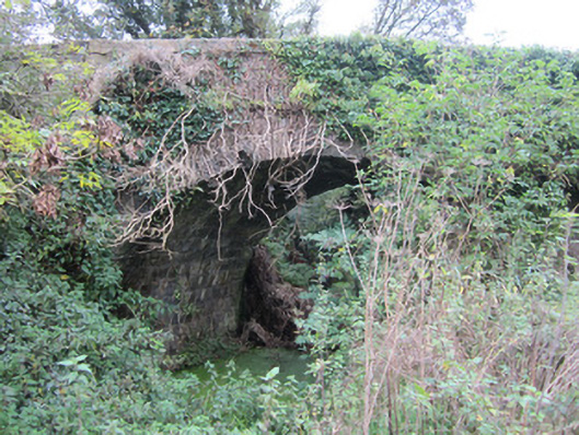
bridge — Monaghan is recorded as bridge in Monaghan. Single-arch limestone canal bridge, built c.1839, carrying byroad over Ulster Canal and towpath between seventeenth and eighteenth locks. Parapet walls constructed of roughly squared random rubble with heavy flat capping stones having rounded arrises and punch-finished surface.
Why it was built
The saved account records: Single-arch limestone canal bridge, built c.1839, carrying byroad over Ulster Canal and towpath between seventeenth and eighteenth locks.
People and work
The saved account records: Parapet walls constructed of roughly squared random rubble with heavy flat capping stones having rounded arrises and punch-finished surface.
How it changed
The saved account records: Section of parapet to north-east end reconstructed using concrete blocks faced with rubble sandstone.
What survives
The saved account records: Projecting square string course separates parapet from spandrels which have same construction as parapet walls.
Why it mattered
bridge — Monaghan matters for the exact reasons given in its official assessment, rather than merely because it is an old structure. The source records: This is a good example of mid-nineteenth-century canal bridge architecture. It stands as a functioning and graceful element of a now disused canal scheme. Although there have been a number of repairs to the parapet walls, the high standard of design and well executed masonry of the original structure has enabled the continued use of this bridge over one hundred and fifty years after its construction. This explains what the place adds to local life, the street or the surviving built history.
History checked 15 August 2026 against the named sources below.
Add the human story, a picture, a first-hand message or a missing place.
Earn 5 points after the picture is checked and accepted.
Add a pictureAdd its storyTalk or ask a questionAdd a new placeThis official record and map point do not grant access. Most recorded buildings are privately owned; view them only from public ground unless the owner allows entry.
Conversation about this place
Questions and messages sit beneath the source record. They are checked before appearing.
No questions or messages yet.
Ask a question or join the conversation