Overview
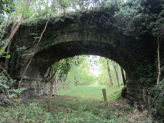
bridge — Monaghan is recorded as bridge in Monaghan. Single-arch sandstone road-over-railway bridge, built c.1860. Part of Portadown & Cavan branch of Ulster Railway.
Why it was built
The saved account records: Single-arch sandstone road-over-railway bridge, built c.1860.
People and work
The saved account records: Part of Portadown & Cavan branch of Ulster Railway.
How it changed
The saved account records: Elliptical arch with margined rock-faced voussoirs, parapets, abutments and plinths.
What survives
The saved account records: Dressed rock facing to soffit, tooled squared rubble copings to parapets.
Why it mattered
bridge — Monaghan matters for the exact reasons given in its official assessment, rather than merely because it is an old structure. The source records: In addition to its functional role and aesthetic merit, this single-arch structure also demonstrates impressive engineering and skilled masonry techniques in the high-quality margin details to much of the sandstone used in the construction. Fitting well with its surrounding environment, the bridge represents the manner in which bridges were tailored into the surrounding rural landscape thus minimising the visual impact of such impressive structures at the dawn of the age of steam. The line was closed c.1957 and today, whilst the bridge is still used for the purpose of farm vehicles bridging the gorge where once… This explains what the place adds to local life, the street or the surviving built history.
History checked 15 August 2026 against the named sources below.
Add the human story, a picture, a first-hand message or a missing place.
Earn 5 points after the picture is checked and accepted.
Add a pictureAdd its storyTalk or ask a questionAdd a new placeThis official record and map point do not grant access. Most recorded buildings are privately owned; view them only from public ground unless the owner allows entry.
Conversation about this place
Questions and messages sit beneath the source record. They are checked before appearing.
No questions or messages yet.
Ask a question or join the conversation