Overview
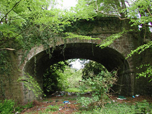
bridge — DUNSANY is recorded as bridge in Meath. The saved source gives an exact reason to look beyond the map label: Single-arch rock-faced limestone railway bridge with string courses and copings, built c.1850, carrying the road over the former railway track which is now disused.
Why it was built
The saved source records: Single-arch rock-faced limestone railway bridge with string courses and copings, built c.1850, carrying the road over the former railway track which is now disused.
People and work
The short source does not safely name the people, events or traditions tied to this exact point. A famous nearby story is not attached without evidence that it belongs here.
How it changed
The saved wording does not establish one complete story of attack, rebuilding, abandonment, damage or later change. No single cause is claimed without evidence.
What survives
The official record fixes the place and calls it bridge. It does not provide a full list of finds or a current condition report, so visible and buried remains are not guessed.
Why it mattered
bridge — DUNSANY matters for the exact reasons given in its official assessment, rather than merely because it is an old structure. The source records: The masonry treatment of this railway bridge adds textural interest to the site. The masonry was clearly executed by skilled craftsmen. This bridge forms part of a group with the related railway structures along this disused line. This explains what the place adds to local life, the street or the surviving built history.
History checked 15 August 2026 against the named sources below.
Add the human story, a picture, a first-hand message or a missing place.
Earn 5 points after the picture is checked and accepted.
Add a pictureAdd its storyTalk or ask a questionAdd a new placeThis official record and map point do not grant access. Most recorded buildings are privately owned; view them only from public ground unless the owner allows entry.
Conversation about this place
Questions and messages sit beneath the source record. They are checked before appearing.
No questions or messages yet.
Ask a question or join the conversation