What is recorded here
Scotland's National Record of the Historic Environment records Bereby as Cargo Vessel (period Unassigned)-(1941). The official map says its point is accurate as follows: NGR given to the nearest 1m. The record does not by itself mean that the public may enter the place.
The *Bereby* was a cargo vessel active in 1941, likely operating in Scottish waters during World War II. It was lost without recorded casualties, though the exact cause and cargo details remain unspecified, leaving its historical significance primarily regional.
The historic-place record does not grant public access. Check current conditions and ownership before entering land or a building.
Places near here
 Isabella TowerTower · 1470 yd
 Harbour and rope walk: Killough Harbour in KilloughHarbour and rope walk: Killough Harbour · 1675 yd
 CASTLE in KilbrideCASTLE · 1680 yd
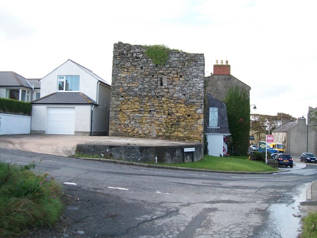 TOWER-HOUSE: MARGARET'S CASTLE in ArdglassTOWER-HOUSE: MARGARET'S CASTLE · 1688 yd
 Water Safety Information - Killough Harbour (Castle)Visitor information · 1706 yd
 Water Safety Information - Killough HarbourVisitor information · 1713 yd
 MODERN CHURCH ON EARLIER SITE in ArdglassMODERN CHURCH ON EARLIER SITE · 1.0 mi
 Curlew PointHeadland · 1.2 mi
 Enclosure/Building in ArdtoleEnclosure/Building · 1.3 mi
 CHURCH (in ruins) & GRAVEYARD: ARDTOLE CHURCH; ST.NICHOLAS' in ArdtoleCHURCH (in ruins) & GRAVEYARD: ARDTOLE CHURCH; ST.NICHOLAS' · 1.7 mi
 Ardtole ChurchWalking route · 1.7 mi
 Sheepland Harbour PathWalking route · 2.7 mi