What is recorded here
On an E-facing slope in undulating grassland, and immediately SW of a byroad. A large circular barrow in fair condition, though partially obscured by overgrowth and field clearance. It comprises a flat central area encircled by an internal fosse, inner bank (E-W 54m, N-S 53.5m), intervening fosse and outer bank. No trace of the enclosing elements survive from N to E, probably as a result of the road widening carried out in 1972. However, 3rd ed. of OS 6-inch map (1932) shows small gaps at E and S, the former possibly corresponding to a water-filled hollow on the line of the inner fosse and bank. In 1972, a small inconclusive rescue excavation (Champion and Champion 1973, 13) was carried out on the enclosing elements at N. (see also Waddell 1977, 59)
The above description is derived from the published 'Archaeological Inventory of County Galway Vol. II - North Galway'. Compiled by Olive Alcock, Kathy de hÓra and Paul Gosling (Dublin: Stationery Office, 1999).
Date of upload: 05 August 2010
A Neolithic ring-barrow; significant as a rare surviving example of early funerary monument construction in the region.
The monument record does not grant public access. Check the route and ask the landowner before entering private land.
- What survives
- Recorded monument
Places near here
 Enclosure in Grange (doonbally Ed)Enclosure · 1124 yd
 Cross in Lenamore (dunmore By.)Cross · 1379 yd
 Massmore Househouse · 1.2 mi
 Site of Doonbally CastleCastle, unclassified · 1.3 mi
 Bawn in Kilcloony (dunmore By.)Bawn · 1.3 mi
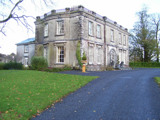 Quarrymount Househouse · 1.5 mi
 European ashEuropean ash · 3.2 mi
 Mass RockNamed rock · 5.0 mi
 KnockmaaWood · 8.2 mi
 Knockmoy AbbeyHeritage attraction · 10 mi
 Kilcoona Round TowerHeritage attraction · 12 mi
 Settlement desertedSettlement deserted, medieval · 1391 yd