What is recorded here
Ballyederlan Fairy Fort is a 25.5-metre earthen ring on a Donegal ridge, its flat interior rising above marshy pasture while the eastern bank has largely vanished. The site may have served as a seasonal dwelling or a boundary marker for local herds, yet the missing wall and wet ground suggest it also belonged to a world where human tools failed and imagination took over.
Internal diam. 25.5m. A subcircular platform up to 1.3m above the surrounding land enclosed by an earthen bank up to .7m high which has been largely removed on the E side. The interior is flat. The surrounding ground is marshy but there is no specific evidence for a fosse. The site is located on top of a slight ridge in generally good pasture.
The above description was derived from the 'Archaeological Survey of County Donegal. A description of the field antiquities of the County from the Mesolithic Period to the 17th century.' Compiled by: Brian Lacey with Eamon Cody, Claire Cotter, Judy Cuppage, Noel Dunne, Vincent Hurley, Celie O'Rahilly, Paul Walsh and Seán Ó Nualláin (Lifford: Donegal County Council, 1983). In certain instances the entries have been revised and updated.
Date of upload: 22 September 2008
The monument record does not grant public access. Check the route and ask the landowner before entering private land.
- What survives
- Recorded monument
Places near here
 Ballyederlan Ridge Fairy FortFairy fort / earthen ringfort · 265 yd
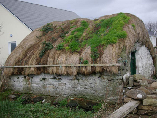 outbuildingoutbuilding · 502 yd
 Ballyederlan Raised Fairy FortFairy fort / earthen ringfort · 516 yd
 Ballysaggart FriaryReligious house, Franciscan Third Order Regular · 1299 yd
 Bawn in Rahan NearBawn · 1.1 mi
 Killaghtee Old Church GraveyardGraveyard · 1.7 mi
 GinkgoGinkgo · 2.1 mi
 European BeechEuropean Beech · 2.3 mi
 Carntullagh HeadHeadland · 2.3 mi
 Rotten IslandIslet · 2.4 mi
 Rashenny PointHeadland · 2.5 mi
 Rabley HillMountain / peak · 2.7 mi