What is recorded here
Ballydoogan Castle stood as a three-storey tower house in 1574 under Tege Mc Gill patrick, but human greed dismantled its stones by 1933. The building did not vanish so much as it invaded the neighbourhood, hiding inside outhouse walls, garden boundaries and roof joists. What remains is a ghost made visible through reused arches and buried foundations, waiting for someone to stop treating the past as rubble and start reading it as a living language.
In pastureland, immediately to the NW of 'Ballydoogan House' (GA106-020001-). In existence in 1574 when 'Bealladugane' castle was in the possession of 'Tege Mc Gill patrick' (Nolan 1901, 111). Evidently still standing at time of the 1838 edition of the OS 6-inch map (see O' Flanagan 1927, Vol. 1, 495), but demolished by the time of 3rd edition (1933) when the words 'Site of' are appended. A photograph taken c. 1892 indicates that the tower house was in a ruined state and was at least three storeys high (O'Riordan 2015, 24). When initially visited by the Galway Survey in April 1983, it was noted that traces of a wall (L 1.95m; H 2.9m) with a base-batter (H 1.65m; splay 0.07m) were incorporated into the SE corner of the wall on outhouse. Another section of walling (L 4.1m; H 2.9m) also appeared to be incorporated into the E wall of an adjoining garden to the S of this building. It was concluded that the two sections of walling may have been the remains of the NE angle of the castle (SMR file). However, on re-inspection in June 2017, it was noted that the wall with the batter most likely continued further to the E as the digging of a trench (5m N-S; 2m E-W; D 2m) immediately to the rear of Ballyduggan House revealed the foundations of a wall (D c. 1m; Wth 0.4-5m), in line with this wall, in the W face of the trench. It is more likely that this the SW angle tower on an associated bawn wall. No visible surface trace of the tower house survived. However, a possible external wall-face (L c. 3m) was also evident running along the E side of the trench. The latter probably marks the site of the tower house and ties in with the evidence of the photograph. Architectural fragments including an arch stone of a doorway and the top of an ogee-window head, now located on the W wall of the garden, are most likely from the tower house. Other pieces of dressed stone from it have been reused in the outhouses to the rear of the house. A number of massive timber beams that have been reused as joists in an outhouse to the W are also likely to be from the tower house.
Compiled by: Olive Alcock
Date of revised upload: 28 August 2017
Ballydoogan Castle was held by Tege Mc Gillpatrick in 1574 and is remembered as part of the historical landscape associated with the Nolan family and early Irish land holdings. Its significance lies in its connection to documented Gaelic landownership in the region during the 16th century.
The monument record does not grant public access. Check the route and ask the landowner before entering private land.
- What survives
- Recorded monument
Places near here
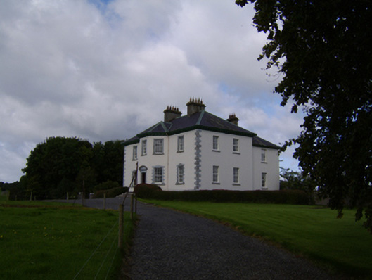 Ballydoogan Housecountry house · 20 yd
 Old R.C. Chapel (in ruins)Chapel · 870 yd
 Leaght LiocanLeacht · 1155 yd
 Kilcooly Castle (in ruins)Castle, tower house · 1466 yd
 Enclosure in KilcoolyEnclosure · 1.0 mi
 Drought Castle (in Ruins)Castle, tower house · 1.5 mi
 Dartfield Horse MuseumHeritage attraction · 1.5 mi
 Stone Islands SouthIslet · 3.6 mi
 Long PointHeadland · 3.6 mi
 Bush IslandIslet · 3.7 mi
 Turoe StoneHeritage attraction · 4.9 mi
 Quarryhill WoodWood · 6.4 mi