What is recorded here
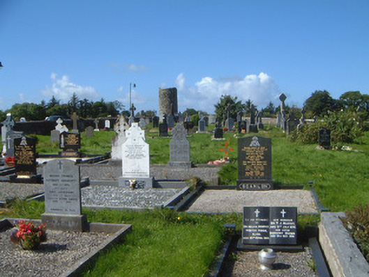
Located on the NW edge of Drumcliff graveyard (SL014-084002-), incorporated into the 19th-century mortared stone wall which encloses the graveyard.
This medieval plain stone cross is indicated on the 1838 OS 6-inch map as ‘Ancient stone’ on the 1940-41 OS 6-inch map. It consists of the cross shaft set in a stone base block. The head of the cross is missing.
The base block consist of a large, worked boulder, rectangular in plan (c. 1m NNE−SSW; c. 0.8m WNW−ESE; H 0.5m) which tapers towards a flat top with a central mortise, in which the cross shaft is set. The shaft is fashioned from rough-textured, brown sandstone. It is rectangular in cross-section (Wth 0.58m; T 0.26m), and tapers gently from base to top, rising to a height of 2.86m above the base block. Both the base block and shaft are devoid of decoration. There is a high cross (SL008-084004-) 30 m to E.
Attached images:
SL008-084005-_01.JPG Viewed from NW
SL008-084005-_02.JPG Viewed from N
SL008-084005-_03.JPG Viewed from SE
Compiled by: Jane O'Shaughnessy
Date of upload: 3 November 2020
The monument record does not grant public access. Check the route and ask the landowner before entering private land.
- What survives
- Recorded monument
Places near here
 Stone crossCross, High cross · 23 yd
 Round Tower (in Ruins)Round tower · 46 yd
 graveyard/cemeterygraveyard/cemetery · 84 yd
 Grave of WB YeatsHeritage attraction · 118 yd
 Drumcliff CemeteryGraveyard · 131 yd
 Saint Columba's Church (Drumcliff)church/chapel · 137 yd
 CastleCastle, unclassified · 1155 yd
 Castle (in Ruins)Castle, unclassified · 1.2 mi
 Floods WoodForest · 1.6 mi
 Kings MountainMountain / peak · 2.0 mi
 Paddy McGowan's WoodWood · 2.1 mi
 Finned PointHeadland · 2.2 mi